Dyrhólaey Lighthouse Walk: Routes, Times, and Closures
Dyrhólaey Lighthouse Walk: Routes, Times, and Closures
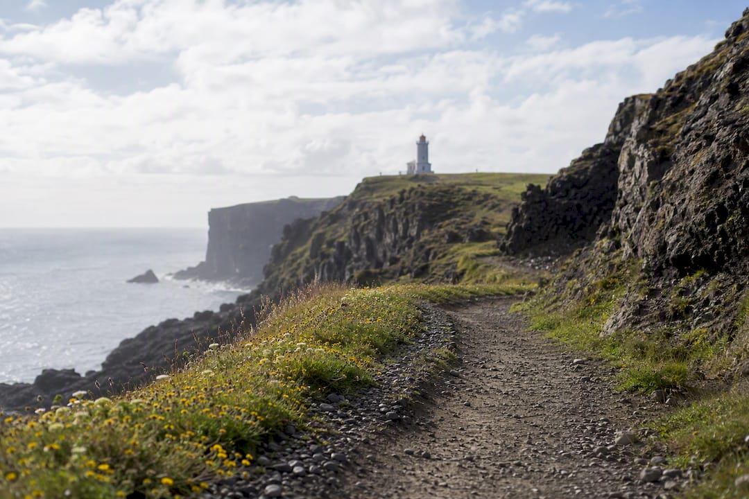
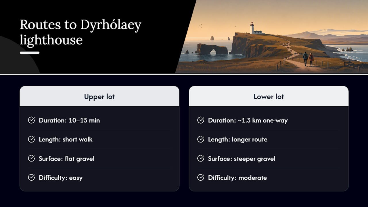
Yes, there is a clear, marked path to the Dyrhólaey lighthouse, and it comes in two versions. Park at the upper lot and you’re standing at the lighthouse in 10 to 15 minutes flat. Park below and hike up, and you’re looking at a 1.3 km one-way route that turns into a 1 to 2 hour round trip once you factor in the views you’ll stop for.
The catch is timing. During puffin nesting season, the upper headland closes overnight to protect the birds, so the quick version isn’t always available. Parking runs through the Parka app, cell signal on the peninsula is spotty, and the wind up top can be strong enough to rip a car door out of your hand.
- Fast option: upper lot to lighthouse, 10 to 15 minutes each way
- Full hike: lower lot to upper viewpoint, roughly 1 to 2 hours round trip
- Watch for: seasonal nesting closures, high winds, and parking payment before you lose signal
Key Takeaways
The Dyrhólaey lighthouse walk works because it offers two distinct routes, both blocked or shaped by seasonal nesting closures and unpredictable coastal wind.
| Point | Details |
|---|---|
| Two route options | Upper lot gives a 10 to 15 minute walk; lower lot gives a 1.3 km, 1 to 2 hour round trip hike. |
| Watch nesting closures | The upper area often closes 19:00 to 09:00 from early May to mid-June to protect puffins. |
| Pay parking before arrival | Set up Parka with site code 8202 in advance since cell coverage on the peninsula is unreliable. |
| Choose your lot by comfort | Lágey suits 2WD drivers and hikers; Háey suits confident drivers wanting a fast visit. |
| Pack for wind | Bring a windproof layer and hold your car door in gusts on the exposed headland. |
Table of Contents
- How to Reach Dyrhólaey and Where to Park
- What Does the Route Actually Look Like?
- Is the Trail Safe, and What Should You Pack?
- When Does Dyrhólaey Close for Puffins?
- When Is the Best Time to Visit?
- Where to Stand for the Best Views and Photos
- How Does Parking Payment Actually Work?
- Why a South Coast Base Makes This Easier
- Is the Longer Hike Worth It?
- Frequently Asked Questions
- Sources
How to Reach Dyrhólaey and Where to Park
You’ll turn off Route 1 onto Route 218, a signposted junction that’s easy to spot if you’re driving the south coast between Vík and Reynisfjara. From Vík, the drive takes about 10 to 15 minutes. From Reykjavík, expect a drive of a couple of hours depending on stops, since Dyrhólaey sits deep into the south coast run.
Once you’re on Route 218, you’ll hit a fork that decides your entire visit: upper lot or lower lot.
- Take the upper road (Háey) if you want the fastest possible visit. It’s steep, narrow, and gets tight when tour buses and rental cars pass each other, but it drops you within a short walk of the lighthouse itself.
- Take the lower lot (Lágey) if you’re not confident on a steep gravel incline, or if you’d rather hike. It has toilets, more space to park, and works fine for a standard 2WD car.
- Check conditions before committing to Háey in winter. The upper road closes during icy or high wind conditions, and there’s no cell signal up there to check road status once you’ve committed.
A 2WD rental handles both lots without issue in clear summer weather. Come in winter, or on a windy shoulder season day, and a 4x4 gives you real margin for error on the upper approach. Locals who drive the peninsula regularly tend to default to parking at Lágey and hiking up rather than risk the narrow upper switchbacks, and it’s not a bad habit to copy if you’ve never driven Icelandic gravel roads before.
What Does the Route Actually Look Like?
The two routes feel like different attractions, honestly, even though they end at the same lighthouse.
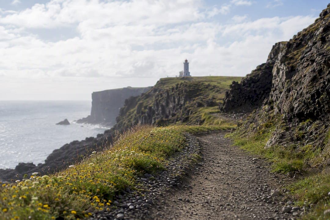
From the upper lot, the path is short and mostly flat gravel with a couple of narrow single-track stretches near the cliff edge. You’ll reach the lighthouse viewpoint in about 10 to 15 minutes from your car, and most of that time is spent taking photos rather than walking.
From the lower lot, you’re looking at a longer, more textured walk. The path climbs from Lágey up toward Háey along the clifftop, gaining elevation gradually rather than in one steep push. Trail-mapping platforms like Komoot list full loop variations around 3.8 to 4.2 km, rated easy to moderate, which lines up with what most fit visitors report: manageable, but not a stroll.
Landmarks to expect along the way:
- The natural stone arch viewpoint, visible from several points on the trail and one of the most photographed features on this stretch of coast
- A cave viewpoint partway up, where the cliff face opens into a hollow you can see into but not enter
- Toilets at Lágey, the only facilities on the entire route
For navigation, search “Dyrhólaey Lighthouse” or “Dyrhólaeyjarviti” directly in your GPS or maps app rather than just “Dyrhólaey,” which sometimes drops a pin at the wrong car park. Trust the signage at the trailhead over any secondary route suggested by a hiking app.
Pro Tip: If your phone GPS struggles with the exact turnoff, use the Komoot route link and download it before you lose signal near the coast. Cell coverage disappears fast once you’re past Vík.
Is the Trail Safe, and What Should You Pack?
Wind is the real hazard here, not the walking itself. The headland catches gusts that feel dramatically stronger than what you experienced back on Route 1, and South Iceland’s own visitor guidance specifically warns about securing loose items and keeping distance from the cliff edge. Car doors get torn off hinges here more often than people expect. Hold onto yours when you open it in a stiff breeze.
Weather flips fast, even in July. Pack for four seasons in one afternoon:
- A waterproof, windproof outer layer, non-negotiable on an exposed clifftop like this
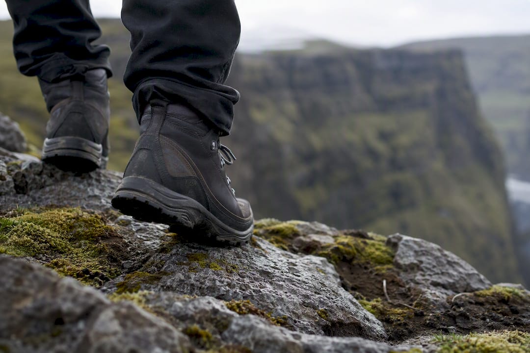
- Sturdy footwear with real tread. The gravel path gets uneven and slick after rain
- A warm mid-layer, since wind chill drops the felt temperature well below what the forecast says
The upper road’s steepness compounds the wind problem. A gust that’s merely annoying while walking can be genuinely dangerous while you’re navigating a narrow gravel incline in a rental car. If you’re not confident driving in those conditions, the lower lot and the hike up removes that risk entirely.
Basic trail sense applies the rest of the way: watch your footing on loose gravel, don’t approach the cliff edge for a photo, and give yourself extra time if the wind is forecast above what feels comfortable at sea level.
When Does Dyrhólaey Close for Puffins?
Part of the upper headland shuts down seasonally, and it catches a lot of visitors off guard.
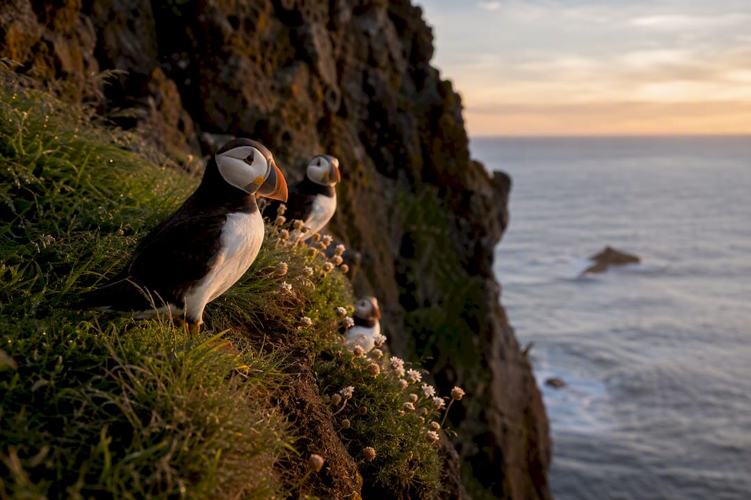
During the nesting period, typically early May through mid-June, the reserve restricts access to protect the birds, with the upper area around the lighthouse often closed between 19:00 and 09:00. Puffins nest in the cliffs mainly during the spring and summer months, and their presence extends beyond the overnight closures designed to protect them.
- Closed zone: the upper Háey area near the lighthouse, during the posted overnight hours
- Why it matters: disturbing nesting burrows can cause puffins to abandon them entirely
- Etiquette: stay on marked trails, keep your distance from burrow entrances, and skip the drone or loud group photo op
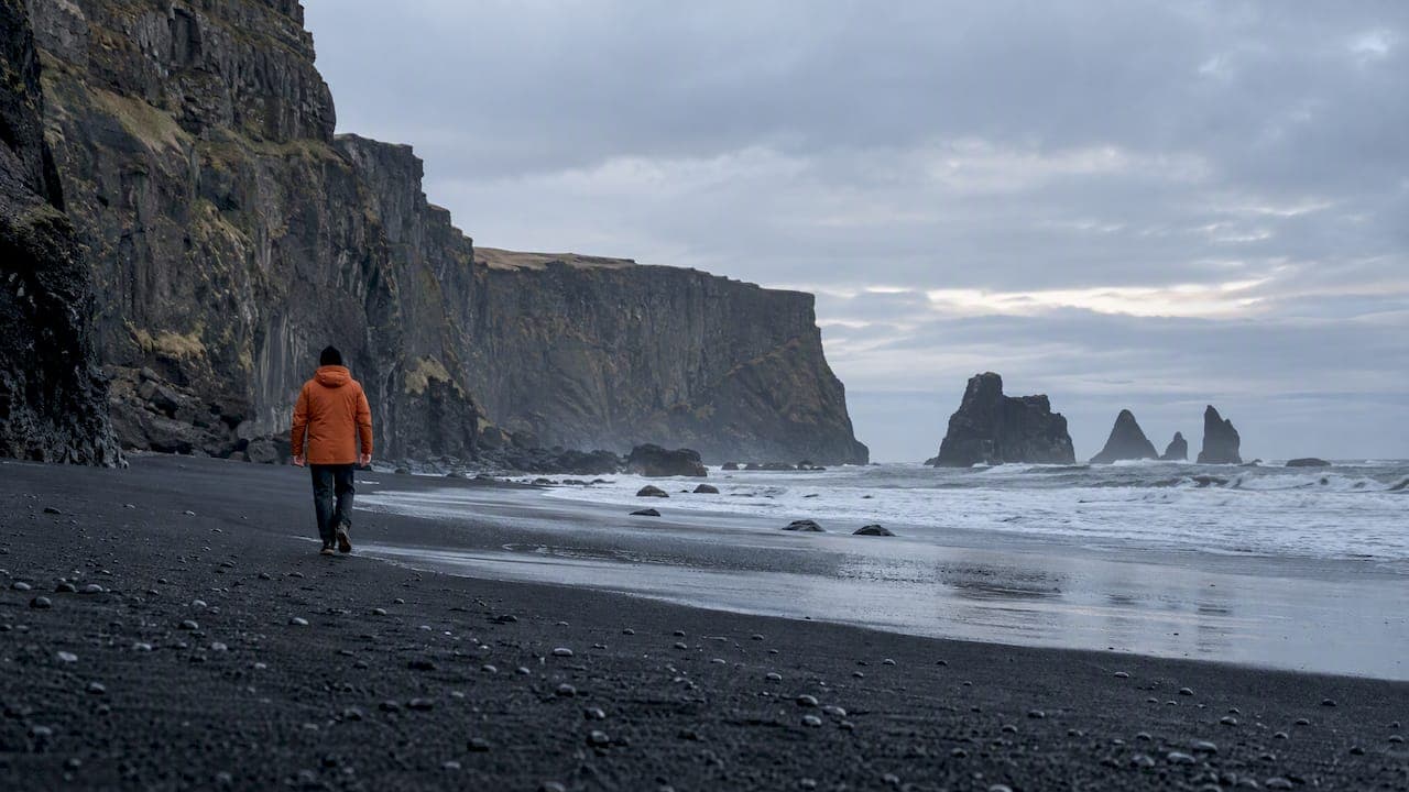
If you arrive during a closure, don’t force it. Reynisfjara beach, a short drive back toward Vík, gives you a strong alternative view of the same headland and arch, often more dramatic from beach level than from above.
When Is the Best Time to Visit?
Timing your visit around puffins, light, and crowds takes a bit of coordination, but it’s not complicated once you know the constraints.
- For puffins, come between late May and mid-July, during daylight hours when the upper area is open (generally 09:00 to 19:00 in nesting season).
- For photography light, early morning or the hours before sunset give you softer light on the cliffs and fewer tour buses crowding the upper lot.
- For a quiet visit, avoid midday in July and August, when both parking lots fill with coach traffic.
- For time budgeting, allow 30 minutes total if you’re only doing the upper lighthouse viewpoint, or 2 to 3 hours if you’re hiking from Lágey and want to linger at the arch and cave viewpoints.
Where to Stand for the Best Views and Photos
The arch is the shot everyone comes for, and the clearest angle is from the clifftop path on the upper side, looking back toward the black sand beach. Get there early or late in the day to avoid a line of tripods.
- For the arch and panorama: the marked viewpoint just past the upper parking area, not the crowded pullout right at the lighthouse base
- For puffins: bring a telephoto lens and stay on the trail. Approaching burrows for a closer shot is exactly the behavior that pushes birds off their nests
- For beach-level shots: watch the tide and never turn your back on the surf. Sneaker waves along this stretch of coast have caught photographers off guard before
- For composition: shoot the arch with the lighthouse in the background for scale, or frame the cliffs with the black sand curve of Reynisfjara in the distance
Pro Tip: Late afternoon light rakes across the cliff face and makes the basalt texture pop far more than flat midday sun. It’s worth timing a return trip if your first visit lands at noon.
You cannot go inside the lighthouse itself, but you can walk fully around the exterior, and the 360 degree view from its base is the real reward anyway.
How Does Parking Payment Actually Work?
Parking at Dyrhólaey runs through the Parka app, using site code 8202, with license-plate recognition cameras enforcing payment rather than a ticket machine or barrier. You can technically pay up to 24 hours after leaving, but don’t count on doing it from the car park itself.
- Download Parka before you leave your accommodation. Cell coverage on the peninsula is unreliable, and the app won’t load a payment screen with no signal
- Facilities differ by lot. Lágey has toilets. Háey has none
- Nearest services are back in Vík, roughly 10 to 15 minutes away, for fuel, food, and restrooms if Lágey’s are your only option
Why a South Coast Base Makes This Easier
Getting the timing right on a walk like this comes down to information you’d otherwise have to piece together from three or four different websites. Staying somewhere with local, current knowledge of closures and road conditions saves that scramble.
- Confirm nesting closure dates before you drive out. A wasted trip to a locked gate is avoidable
- Pair Dyrhólaey with Reynisfjara in the same outing since they sit minutes apart
- Ask locally about road conditions on the upper Háey approach if you’re visiting outside summer
Guests staying along this stretch of coast consistently ask the same question: is it open right now? Getting a straight answer before you drive out beats guessing from a blog post written eighteen months ago.
Fox Hostel sits roughly 35 minutes east of Vík in Hrífunes Nature Park, positioned as a base for exactly this kind of day. Guests plan their Dyrhólaey visit alongside Reynisfjara and the rest of the South Coast itinerary using local knowledge that’s harder to find from a hundred miles away, and the hostel’s own guide to Dyrhólaey covers the geology and viewpoints in more depth for anyone planning a slower visit.
Is the Longer Hike Worth It?
If conditions are calm and you’ve got a couple of hours to spare, take the lower lot and walk up. You’ll pass the arch from angles the ten-minute crowd never sees, and you’ve got a real shot at spotting puffins along the cliff path rather than just at the summit viewpoint.
Skip the upper lot entirely if the wind is genuinely strong, the road is icy, or you have any mobility concerns that make a steep narrow gravel incline unwise. There’s no view worth a car door snapping off in a 60 mph gust.
One more thing: this is a nature reserve, not a photo backdrop. The closures exist because previous visitors ignored them. Stay on the marked path, and the puffins keep coming back every spring.
Frequently Asked Questions
Is there an actual walking path to Dyrhólaey lighthouse? Yes. A marked path runs from both parking lots, with a short 10 to 15 minute option from the upper lot and a longer route of about 1.3 km one way from the lower lot.
Can you go inside the lighthouse? No. You can walk around the exterior and use the surrounding cliff viewpoints, but the lighthouse building itself is closed to visitors.
When is Dyrhólaey closed for puffins? The upper area typically closes overnight between 19:00 and 09:00 from early May through mid-June, though puffins nest in the cliffs from late April to mid-August.
Do I need a 4x4 to drive up to the lighthouse? A standard 2WD car handles both parking lots fine in clear summer weather. In winter or high wind, a 4x4 gives more margin on the steep upper road, which can also close entirely in icy conditions.
How do I pay for parking at Dyrhólaey? Parking uses the Parka app with site code 8202, enforced by license-plate cameras. Set up payment before you leave your accommodation, since cell signal on the peninsula is unreliable.
Sources
- Visiting Dyrhólaey: What to know before you go | South Iceland
- Parka - Dyrhólaey
- Dyrhólaey - Plan Pack Explore