Fjaðrárgljúfur Canyon: Is the South Coast Detour Worth It?
Fjaðrárgljúfur Canyon: Is the South Coast Detour Worth It?
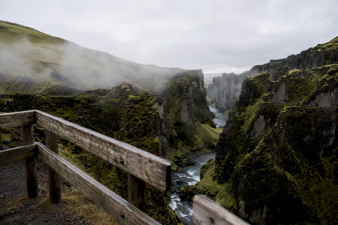
Yes. Fjaðrárgljúfur canyon earns its place on a South Coast itinerary when weather cooperates and you build in the time. The rim walk takes 45 to 90 minutes depending on pace and how many photos you stop for, the turnoff sits just off Route 1 near Kirkjubæjarklaustur, and parking runs through the Parka license-plate system rather than a cash gate.
Skip it only if your day is already packed edge to edge, or if the site is closed for weather or conservation reasons. Check before you drive out.
- Rim walk time: 45 to 90 minutes round trip
- Distance from Route 1: about 5 to 6 km via the F206
- Parking: paid, through Parka, license-plate recognition
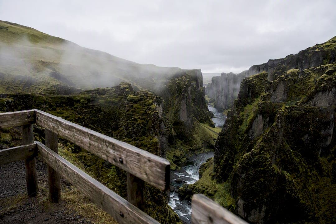
Quick stat: the canyon runs roughly 2 kilometers long and drops close to 100 meters at its deepest point, carved into soft palagonite tuff that erodes fast and damages easily underfoot.
One safety note that matters more than any other here: stay on the marked rim path. The ground is softer than it looks, closures have happened before to let vegetation recover, and the canyon floor is not part of the modern visitor experience.
Key Takeaways
Fjaðrárgljúfur rewards a planned stop of 45 to 90 minutes on the marked rim path, paid parking through Parka, and a visit timed for dry summer conditions or a careful weather check otherwise.
| Point | Details |
|---|---|
| Worth the detour | Add it when your route has margin and weather allows; skip it on a packed Reykjavík to Vík day. |
| Access is straightforward | Turn off Route 1 onto the F206, about 5 to 6 km of gravel, manageable by 2WD in dry summer. |
| Parking requires action | Pay through Parka right away; the system gives roughly a 24-hour window before claims follow. |
| Stay on the rim | The path stays up top by design; the canyon’s soft palagonite tuff has closed before from foot traffic damage. |
| Time it right | Budget 45 to 90 minutes and aim for early morning or evening light in June through September. |
Table of Contents
- What Are the Basic Facts About Fjaðrárgljúfur Canyon?
- How Do You Get to Fjaðrárgljúfur Canyon by Car?
- What Does the Fjaðrárgljúfur Hike Actually Involve?
- When Is the Best Time to Visit Fjaðrárgljúfur?
- How Can You Get the Best Photos at Fjaðrárgljúfur?
- Which Other South Coast Stops Pair Well with Fjaðrárgljúfur?
- What Should You Pack for the Fjaðrárgljúfur Hike?
- Where Can You Stay Near Fjaðrárgljúfur for an Early Start?
- Where Can You Check Current Access and Parking Conditions?
- What’s Overrated and What Actually Matters at Fjaðrárgljúfur?
- Sources
What Are the Basic Facts About Fjaðrárgljúfur Canyon?
Fjaðrárgljúfur stretches about 2 kilometers and reaches depths near 100 meters in places, carved by the Fjaðrá river through palagonite tuff, a volcanic rock that’s softer and more prone to erosion than the basalt found elsewhere on Iceland’s south coast. That geology is why the canyon walls curve and fold the way they do, and it’s also why guides keep repeating the same instruction: stay off the moss.
- Length: approximately 2 km
- Maximum depth: close to 100 m
- Location: roughly 5 to 6 km north of Route 1, near the turn for the F206
- Nearest town: Kirkjubæjarklaustur, about 5 minutes’ drive from the parking area
Quick stat: trail-tracking platforms list the round-trip hike at roughly 1.9 miles (about 3 km), with an average completion time near 53 minutes, though most visitors linger longer for photos.
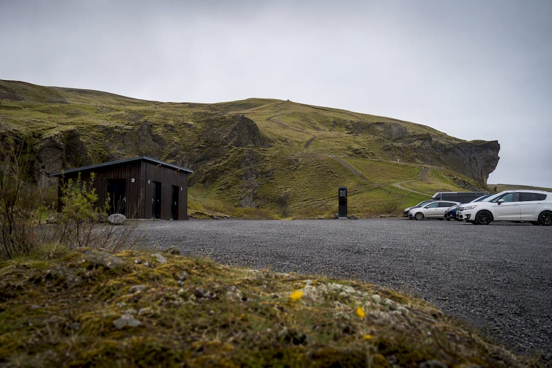
Facilities at the car park are basic: toilets, a payment kiosk for parking, and not much else. If you need food, fuel, or a proper meal, that’s a short drive back toward Kirkjubæjarklaustur, not something you’ll find on site.
How Do You Get to Fjaðrárgljúfur Canyon by Car?
From Route 1, the turn onto F206 sits about 5 to 6 km west of Kirkjubæjarklaustur, clearly signed if you’re watching for it. The road runs north for roughly 5 km of gravel before reaching the parking area, and in dry summer conditions a standard 2WD car handles it fine. That changes fast once rain, mud, or ice enter the picture.
- Turn north off Route 1 onto the F206, watching for the canyon signage.
- Follow the gravel road roughly 5 km; it’s narrow but well maintained in summer.
- Park in the main lot near the trailhead, or use the lower overflow lot if the top one is full during peak hours.
- Pay for parking through Parka before you walk off, either by app or the on-site kiosk.
- Head up the marked rim path toward the first viewpoint.
The road classification (F-road) sometimes spooks renters into assuming they need a 4x4, but the short gravel stretch to Fjaðrárgljúfur is far gentler than the deep river-crossing F-roads in the highlands. Still, check current conditions before you go, especially outside June through September, since a light frost can turn manageable gravel into something you’d rather not attempt in a compact rental.
Parking is where a lot of visitors get caught out. The lot uses Parka, a license-plate recognition system rather than a barrier or ticket machine you feed cash into. You pay through the Parka app or website, and fees for passenger cars have run in the range of ISK 700 to 1,000, though it’s worth confirming the current rate before your trip. Miss payment and you get roughly a 24-hour window to settle up before an administrative claim gets filed, often routed through your rental agency with an added fee attached.
Pro Tip: Pay for parking the moment you arrive, not after your walk. It’s easy to forget once you’re back in the car thinking about the next stop, and that’s exactly how rental companies end up billing you weeks later for a fee you never meant to skip.
If the main lot is full, there’s a secondary lower parking area a short walk further down the access road. It adds a few extra minutes on foot but saves you circling for a spot during the busiest summer weeks.
What Does the Fjaðrárgljúfur Hike Actually Involve?
The rim path follows the canyon’s eastern edge, climbing gradually past three main viewpoints before reaching an observation platform near Mögárfoss, a waterfall that marks the head of the gorge. Most guides put the out-and-back distance somewhere between 1.2 and 2 km one-way, with round-trip figures landing around 1.9 to 2.4 km total.
Elevation gain is modest by Icelandic standards, but don’t mistake “modest” for “flat.” The trail has a few short, steep pushes, and several sections run close to unfenced edges with real drop-offs. It’s not a technical hike, but it demands attention, especially with kids or if the ground is wet.
- Viewpoint 1: roughly 5 to 10 minutes from the car park, offers the classic canyon curve shot.
- Viewpoint 2: slightly further along, higher vantage over the river below.
- Viewpoint 3 and the Mögárfoss platform: the turnaround point, showing the waterfall feeding into the gorge.
Here’s the thing most first-timers get wrong: they treat this like a hike where you’re supposed to get down into the canyon. You’re not. The rim view is the intended experience, and descending onto the canyon floor is both unsafe and, in various places, actively restricted to let the fragile moss and tuff recover from decades of foot traffic. Older trip reports mention scrambling down to the river, but current guidance and local protection measures point firmly toward staying up top.
Budget 45 minutes if you’re moving fast and just want the highlight shots, and closer to 90 minutes if you want to walk the full rim, stop at each viewpoint, and wait out other visitors for a clean photo. Add extra time in July and August, when the parking lot and trail both see their heaviest traffic of the year.
When Is the Best Time to Visit Fjaðrárgljúfur?
June through September gives you the easiest access, the driest gravel road, and the lowest odds of the trail being icy or closed. Outside that window, the F206 and rim path can turn slippery fast, and daylight hours shrink enough in winter that you’ll want to plan your stop with real margin.
Weather here changes faster than it looks on a forecast app. Wind picks up along exposed rim sections without much warning, fog can roll in and erase the view you drove out for, and moss-covered rock turns slick after even light rain. None of that means avoid the shoulder seasons entirely, it just means check conditions the morning you go, not the night before.
The canyon has also closed to visitors in the past when heavy foot traffic damaged the vegetation along the rim, a direct result of the palagonite tuff’s soft, erosion-prone structure. Staying on the marked path isn’t a suggestion, it’s the reason the site stays open to the public at all.
- Wear boots with real grip, not sneakers.
- Avoid the rim edges entirely in high wind.
- Check road.is and local visitor notices before you leave your accommodation.
- Turn back if fog drops visibility near the unfenced sections.
Pro Tip: If you’re chasing dramatic light for photos, know that gorge microclimates shift quickly. A visitor’s guide to gorge weather explains why conditions here can flip from clear to socked-in within the hour, so build a buffer into your schedule rather than betting on a single forecast window.
How Can You Get the Best Photos at Fjaðrárgljúfur?
Early morning and late evening light flatters the canyon’s curves better than the harsh midday sun, which tends to wash out the layered rock and green moss into a flatter, less textured image. Summer’s long daylight hours give you real flexibility here, since “golden hour” can stretch well past 9 PM in June.
- A wide-angle lens captures the full serpentine sweep from the upper viewpoints.
- A short telephoto compresses the canyon walls for a more dramatic, layered look.
- A tripod helps on overcast days when light is flatter and shutter speeds drop.
- Bracket your exposure on bright days, since the sky and canyon shadows often sit at opposite extremes.
- Arrive before 9 AM or after 6 PM in July and August to shoot the main viewpoints without a line of tourists in frame.
Patience beats gear here. The three main viewpoints get crowded in peak season, so waiting a few minutes for a gap in foot traffic usually produces a better shot than fighting for the “perfect” angle.
Which Other South Coast Stops Pair Well with Fjaðrárgljúfur?
Fjaðrárgljúfur works best as a planned stop, not an afterthought squeezed into an already tight day. Its natural neighbors sit close enough that pairing them adds little extra driving.
Heading east from Vík, Reynisfjara Black Sand Beach and Dyrhólaey come first, then Kirkjubæjarklaustur with its Eldhraun lava field and the Dverghamrar basalt columns just before the canyon turnoff. Push further east and you’re looking at Skaftafell and Jökulsárlón Glacier Lagoon, both strong full-day additions if you’re continuing toward Vatnajökull National Park.
- West to east: Vík (Reynisfjara, Dyrhólaey) → Kirkjubæjarklaustur services → Fjaðrárgljúfur (45 to 90 min) → continue toward Skaftafell.
- East to west: Skaftafell or Jökulsárlón → Fjaðrárgljúfur on the return leg → overnight near Vík.
Skip the canyon if you’re attempting Reykjavík to Vík in a single tight day. That drive alone eats most of your daylight, and stacking a rim walk on top usually means rushing both. Bad weather is the other clean skip signal. If the forecast shows heavy wind or fog on the day you’re passing, push the stop to your return leg instead, and check road and access conditions before committing either way.
What Should You Pack for the Fjaðrárgljúfur Hike?
Waterproof boots matter more than almost anything else you’ll pack for this stop. The rim path gets muddy fast, moss holds water like a sponge, and a slick boot sole near an exposed edge is not where you want to test your balance.
- Waterproof boots with real tread, not casual sneakers.
- A wind shell, since the rim sits exposed with little tree cover to block gusts.
- Spare socks if you’re combining this with other wet South Coast stops the same day.
- Crampons or spikes if you’re visiting outside the June to September window and ice is a possibility.
Arrive early if you’re traveling in July or August. The main lot fills fast by midmorning, and circling for a spot burns time you’d rather spend on the trail. Facilities stop at the toilets in the parking area; there’s no café, no snack stand, nothing else on site, so plan food and fuel around Kirkjubæjarklaustur instead.
One more thing worth knowing before you commit: this is not a hike suited to limited mobility. The rim path is uneven, narrow in places, and runs close to unfenced drops, so it’s not a realistic option for wheelchairs, strollers, or anyone unsteady on rough terrain. Families with young kids can manage it with close supervision, but this isn’t a paved, accessible trail by any measure.
Where Can You Stay Near Fjaðrárgljúfur for an Early Start?
Fox Hostel sits roughly midway between Vík and Kirkjubæjarklaustur, which puts Fjaðrárgljúfur within easy striking distance the next morning rather than something you’re rushing to fit in on a long transit day. Staying nearby means you hit the trail early, before the parking lot fills and while the light still has that low, flattering angle photographers chase.
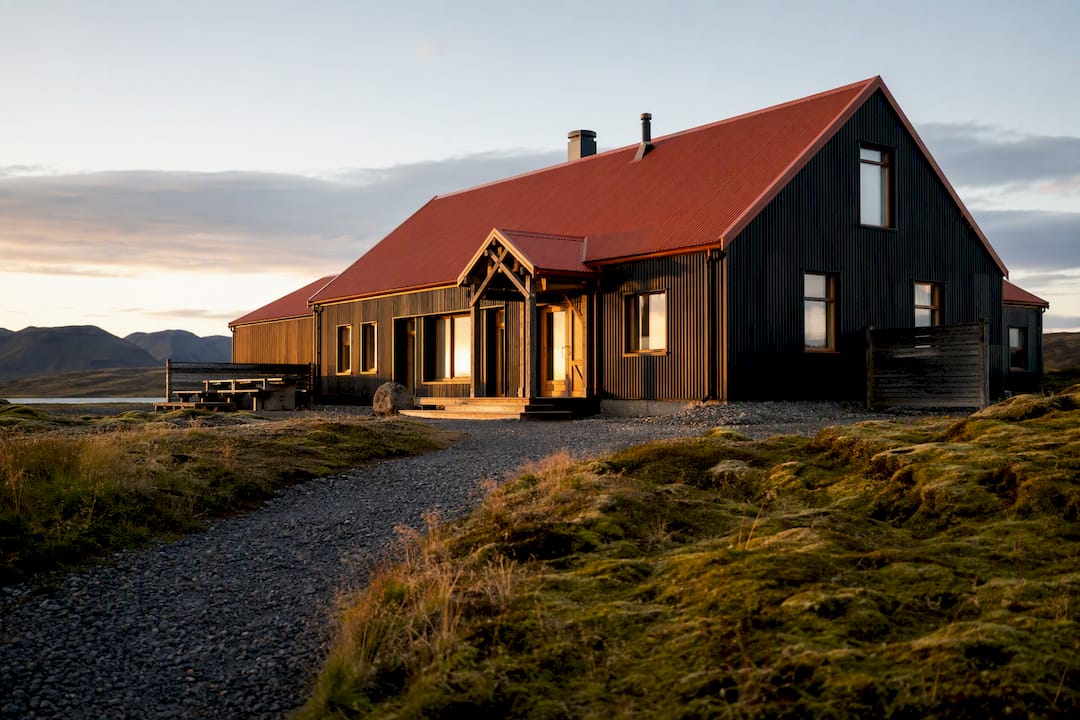
The hostel’s setup fits the kind of trip this canyon attracts. There’s a large communal kitchen if you’re cooking your own meals before an early departure, an on-site pizzeria for the nights you’d rather not, and flexible booking that works whether you’re traveling solo and want a single dorm bed or arriving as a couple or group looking to book out an entire room for privacy.
A sample schedule that actually works: overnight near Vík, leave early for Fjaðrárgljúfur, spend 45 to 90 minutes on the rim, then continue east toward Skaftafell or Jökulsárlón the same afternoon. The location does the planning for you, since you’re never backtracking to cover the distance.
- Midway position between Vík and Kirkjubæjarklaustur cuts driving time to the canyon turnoff.
- Communal kitchen and on-site pizzeria cover meals before or after an early departure.
- Flexible booking suits solo travelers, couples, and groups without forcing a private-room minimum.
Pro Tip: Book your dorm bed or room the night before a canyon visit if you’re aiming for the early light. Getting a head start beats sleeping in and fighting the midday parking crowd every time.
Where Can You Check Current Access and Parking Conditions?
- Parka’s payment page for current parking fees and rules.
- Local visitor guides like Things To Do in Iceland for access notes and closures.
- Trail detail pages such as Onda Travel’s canyon guide for route specifics.
What’s Overrated and What Actually Matters at Fjaðrárgljúfur?
Most guides to this canyon scatter the useful details across a dozen different pages: parking payment on one site, trail distance on another, closure history buried in a forum thread somewhere. That fragmentation is the real problem, not the canyon itself. The site is straightforward once you have the logistics in one place.
What’s overrated is the idea that you need hours here or specialized gear. This is a 45 to 90 minute rim walk, not an expedition. What’s underappreciated is how much the Parka payment window and the F206’s seasonal mood swings trip up otherwise well-prepared travelers, not because the information is hard to find, but because it’s rarely presented alongside the rest of the visit planning.
My honest read: prioritize checking road and closure status the morning of your visit over researching the “perfect” photo spot in advance. Conditions here change faster than most trip blogs account for, and a canyon that’s closed or fogged out makes every other detail irrelevant.
— Siggi
Sources
- Fjaðrárgljúfur Canyon Iceland Guide 2026
- Fjaðrárgljúfur Canyon: South Coast Rim Walk Guide
- Parka: Pay Fjaðrárgljúfur
- Fjaðrárgljúfur Canyon: Hike, Parking and Tips
Recommended
- Imperdibles de la ruta Ring Road: guía 2026 | Fox Hostel – South Iceland
- Ejemplos de rutas en la costa sur de Islandia | Fox Hostel – South Iceland
- Dyrhólaey Lighthouse Walk: Routes, Times, and Closures | Fox Hostel – South Iceland
- How to Visit South Coast Waterfalls in Iceland | Fox Hostel – South Iceland