Fimmvörðuháls Hike: Skógar to Þórsmörk Guide
Fimmvörðuháls Hike: Skógar to Þórsmörk Guide

The Fimmvörðuháls hike is a one-way mountain crossing of roughly 25 km. It starts beside the Skógafoss waterfall on Iceland’s South Coast, climbs to a high pass between two glaciers and ends in the valley of Þórsmörk. Most fit hikers need most of a long summer day, and the real planning problems are the weather, the river-crossing transport at the far end and where you sleep the night before. This guide covers all of it, stage by stage.
TL;DR
- Fimmvörðuháls is about 25 km point to point, with around 1,000 m of climbing, and takes eight to ten hours on average. Allow more if you stop often or the weather turns.
- It is a challenging hike. Bring waterproof boots and clothing, food, water, and a map and compass or GPS.
- The pass is high, exposed and changeable. Check conditions and leave a travel plan with Safetravel before you go.
- The route ends in Þórsmörk, which you reach by road only with a 4x4 and river-crossing experience, so book your ride out in advance.
- Sleep close to Skógar the night before so you can start early. Fox Hostel, in a converted barn near Vík, is a practical base.
Table of Contents
- What the Fimmvörðuháls hike is
- The route, stage by stage
- How hard is it, and who should do it?
- When to go and what to check first
- Getting there and getting back
- What to pack for a ten-hour crossing
- Our perspective on Fimmvörðuháls
- Other Þórsmörk hikes if you want something shorter
- Where to sleep before and after
- A simple plan for your Fimmvörðuháls day
- FAQ
- Sources
What the Fimmvörðuháls hike is
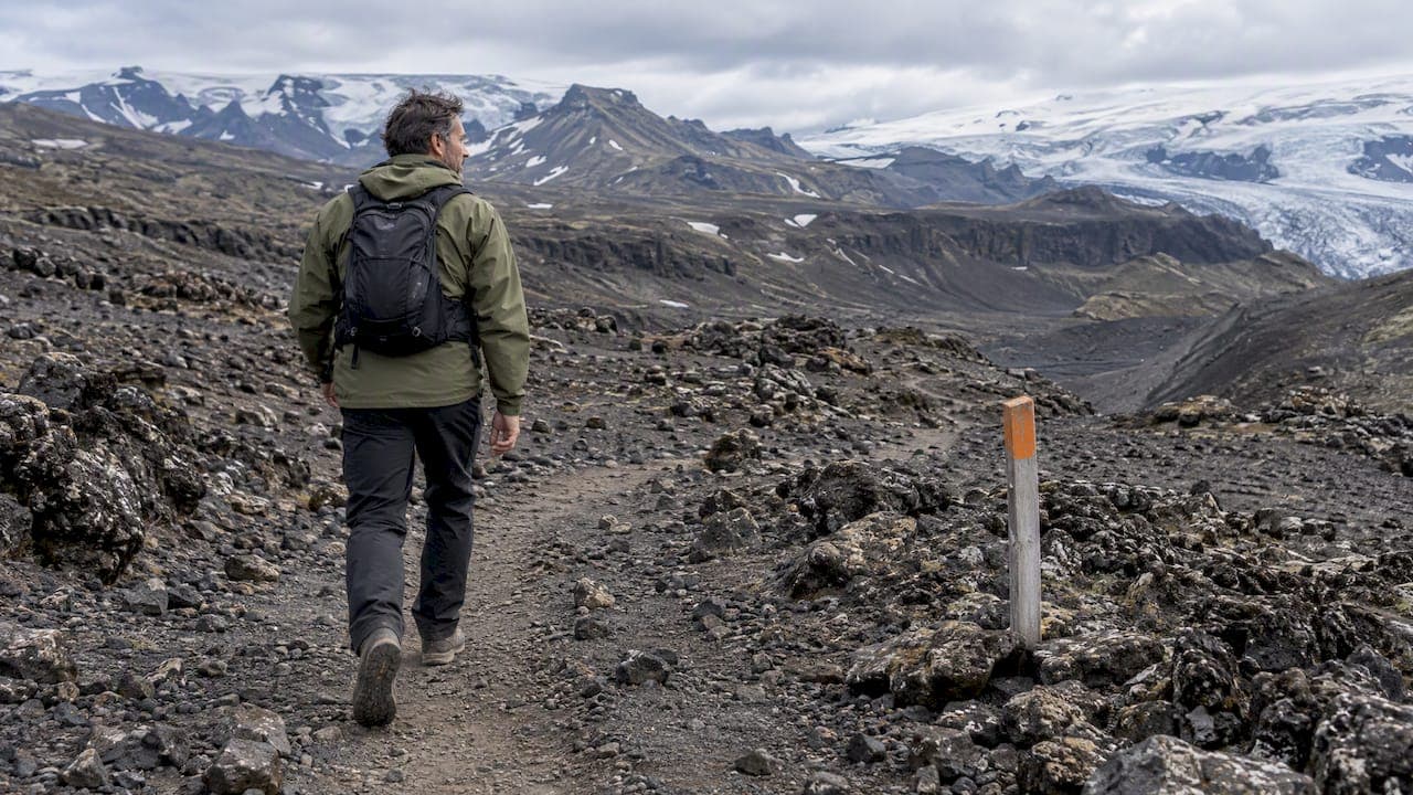
Fimmvörðuháls means roughly “five cairn pass”, and the trail follows the high ground between the Eyjafjallajökull and Mýrdalsjökull glaciers. The route runs from Skógar to Þórsmörk, and the high point sits at about 1,000 m, with the trail dropping to roughly 200 m in the valley. That makes it one of the biggest altitude swings you can fit into a single day in Iceland, from near sea level at the waterfall to bare volcanic plateau and back down into birch woods.
The direction matters. Nearly everyone walks from Skógar to Þórsmörk, because you gain the height early, on a clear path, and then spend the second half descending into one of the most sheltered valleys in the highlands. Walking the other way is possible, but you start in the valley with a climb that is steep and exposed in its final sections.
It is also not a loop. You finish about as far from your car as you can get on the South Coast, which shapes everything about logistics. More on that below.
The route, stage by stage

Guides describe slightly different numbers, from 20 km to 25 km, depending on where the end point is set in Þórsmörk. Plan for the longer figure, because the descent into the valley feels longer than its map distance.
Stage 1: Skógafoss and the river of waterfalls
The trail begins at the base of Skógafoss. A stairway beside the falls takes you onto the plateau above, and from there the path follows the Skóga river upstream. Over the first hours you pass more than 20 cascades of every size, some of them only a short step from the path. This is the most photogenic part of the day, and the biggest temptation to dawdle. Resist it. You will have the same light on the way down if you keep a steady pace.

The gradient is steady rather than brutal. Use this stretch to settle into a rhythm, eat a little every hour and drink before you are thirsty.
Stage 2: Up to the pass between the glaciers
Above the waterfalls the valley opens into tundra, with long views toward the ice. The ground changes to gravel, lava and, early in the season, snow. The research I trust for this section notes barren volcanic ground, lingering snowfields and rapidly changing mountain weather near the pass, and that matches what hikers report: clear in the valley, cloud at the top.
Near the high point the route passes the huts. Baldvinsskáli and Fimmvörðuskáli sit near the high ground, and they are useful landmarks for checking your timing even if you are not staying in them. If you reach this area much later than you planned, that is your signal to decide honestly whether to continue.
Stage 3: The craters of Magni and Móði
The trail then crosses close to the craters Magni and Móði, with dark lava and cinder underfoot. The landscape is strange and young, and in poor visibility it is also the part where you need to follow markers or a track carefully rather than guess. Navigation tools matter here, not only on paper: carry a map and compass or a GPS, and know how to use them.
Stage 4: The descent into Þórsmörk
The second half is a long drop through Goðaland. The path descends via Kattarhryggur, a narrow ridge section, and then through increasingly green terrain toward Þórsmörk, usually ending at Básar. The ridge is the part that bothers people with a fear of heights: narrow sections and rope-assisted passages can be uncomfortable, and tired legs make them feel more exposed than they are.

Birch woods, then river channels and campsite buildings, tell you the day is nearly done. Many hikers describe this as the best moment of the trip: flat paths, shelter and a place to sit down.
How hard is it, and who should do it?
Honestly: hard. The route is long, it climbs about 1,000 m and the terrain stays rough from the first waterfall to the last ridge. A recognised Icelandic guide describes it as challenging and not suitable for people with poor physical health, and recommends training if you are not used to hiking.
A realistic test: can you walk 8 to 10 hours with a daypack, on uneven ground, including a long descent, without stopping to recover for days afterward? If you have not done a full day on your feet in the last few months, build up with a few long hikes first. The down section punishes knees and ankles, so trekking poles help many people.
The route does not need technical mountaineering skills in normal summer conditions. What it needs is stamina, sound footwear, a head for narrow ridges and the discipline to turn around or shelter when the weather closes in.
How long does it take?
The average is eight to ten hours, though times vary with fitness, stops and conditions. Other guides give a range of 8 to 12 hours. Plan for the upper end if you are photographing, carrying a heavier pack or hiking in a group with mixed paces. Start early in the morning so the finish is in daylight, even if you are in Iceland in the long summer light.
Two days instead of one
The huts on the pass allow a two-day crossing, which suits people who want to see the glacier landscape at slower speed or who are not sure about a ten-hour day. Huts and campsites are booked and managed by their operators, so check each one’s current rules and availability with them directly rather than assuming a space.
When to go and what to check first
The high pass is snow-covered for much of the year, and it is the snow, wind and cloud that decide whether it is a good day or a dangerous one. Do not rely on a calendar date. Instead, check the same things every time:
- Current conditions. Open the Safetravel travel-conditions page for alerts and closures, and look at the mountain weather forecast for the pass itself, not for Skógar or Vík.
- Your travel plan. Leave a travel plan with Safetravel and with someone you trust, and update them if your plans change. This takes a few minutes and is the single most useful safety step.
- Snow on the route. Ask the huts or local information centres whether snowfields are still on the path. Navigating snow with low cloud is very different from a clear summer walk.
- River levels. If you cross streams, Safetravel advises crossing in the morning, when levels are often lower, and preferably wading with two or three others with arms clasped at the elbows.
The weather changes fast on this route. A day that starts bright at the waterfall can turn to wind, rain and white-out at the pass. Pack as if you will see all of it. If the forecast is poor, the right call is to wait a day, and the hostel kitchen is a better place to wait than a ridge.
For general guidance on icy and glacier terrain nearby, our own piece on glacier hiking tips covers the preparation mindset, although this trail itself is not a glacier walk.
Getting there and getting back
This is the part many people underestimate. Fimmvörðuháls is one way, so you need a plan for both ends:
- Start at Skógar. Skógar is on the South Coast, right beside the Ring Road and the waterfall car park, so reaching it by car is easy. You have to decide what happens to the car while you are across the mountain.
- Finish in Þórsmörk. Getting to and from Þórsmörk by road requires a 4x4 and experience with river crossings, and Highland Buses are one transport option. Rental agreements often restrict river crossings, so do not assume your ordinary rental car can fetch you.
- Book the ride out early. Check the current bus schedule and booking terms with the operator before you commit to a date, and have a backup if the hike is postponed.
A common pattern is to leave the car at Skógar or at your accommodation, hike across, then take a scheduled highland bus back out of the valley to the Ring Road and onward to where the car is. Whichever approach you use, work out the last departure time out of Þórsmörk and be sure your hiking pace can meet it with margin.
What to pack for a ten-hour crossing
The essentials, drawn from the official and media guidance above, are waterproof boots and clothing, food, water, and a GPS and/or a map and compass. Add the extras that make long days on volcanic ground go smoothly:
- Layers you can add or shed quickly: a base layer, an insulating mid-layer, a windproof and waterproof shell, hat and gloves, even in summer.
- Spare dry socks in a waterproof bag. Wet feet end hikes.
- A headlamp, a charged phone and power bank, and a small first-aid kit with blister care.
- Poles for the long descent, if you use them.
- At least two litres of water capacity. You will pass streams early on, but plan for the dry plateau.
- A foil blanket or emergency shelter. It is light and might be the most important item you carry.
Food matters more than people expect. You will burn a lot, and cold wind makes you want to keep walking rather than stop and eat. Pack things you can eat with one hand while moving: nuts, bars, fruit, sandwiches. If you eat plant-based, vegan hiking snacks built around seed blends are an easy option to prepare in advance, and light enough not to feel like a burden.
Our perspective on Fimmvörðuháls
We sit on the South Coast and talk with hikers every season, so here is what we see from the hostel kitchen.
The people who enjoy this crossing most are not the fastest. They are the ones who treated the logistics as part of the hike: they slept near the start, ate a proper breakfast, left early, checked conditions the night before and knew exactly how they were getting out of the valley. The ones who struggle usually did the opposite, arriving late from a long drive, starting at midday and hoping for the best.
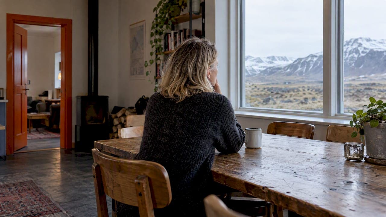
So our advice is simple. Treat the night before as part of the hike. Sort your gear on the table, check the forecast, send your plan to Safetravel and go to bed early. Do not stack Fimmvörðuháls on a day when you also have a long drive. If the weather says no, take it as a gift and spend the day on waterfalls and black-sand beaches instead. The mountain will still be there tomorrow.
And if you are walking solo, remember that shared hostel rooms are a good place to find a hiking partner. Many people on the South Coast have the same plan and the same questions.
— Siggi
Other Þórsmörk hikes if you want something shorter
Not everyone wants a ten-hour crossing, and Þórsmörk rewards a second look. Once you are in the valley, shorter routes start around the huts and campsites, such as the climb of Valahnúkur, a popular viewpoint hike, and longer circuits toward Tindafjöll and Rjúpnafell for strong hikers. Distances and times vary by source and by exactly where you start, so confirm them with the hut wardens or the operators in the valley before heading out.
If you are only after the valley and not the crossing, you can reach Þórsmörk by highland bus and walk there for the day, without doing Fimmvörðuháls at all. For other South Coast day options, our guide to the top adventure activities near Vík and our waterfall exploration tips help you fill the rest of a trip. Heading east instead? Our overview of Skaftafell hikes covers routes from one to eight hours.
Where to sleep before and after
A good night before a ten-hour day is not a luxury. It is part of the plan. Fox Hostel is a converted Icelandic barn in the South Iceland countryside near Vík, a calm base on the South Coast between the big waterfalls and the black beaches. You can book a bed in a shared dormitory if you are travelling alone, or take a private dormitory for a couple or small party. If you are a group of hikers, you can reserve whole rooms together.
Breakfast is served at the hostel, so you can fuel up before an early start, and in the evening Hrífunes Pizzeria is on site, which is welcome after a day on your feet. There is also a communal kitchen and shared spaces to compare notes with other travellers. If you want to rest your legs after the crossing with something less strenuous, we also offer a rafting adventure with a partner operator.

See the rooms and book a bed or a whole room on our accommodation page, or read how our dorm rooms work if you have not stayed in one before. You can also look at booking a table at the pizzeria for your last night.
A simple plan for your Fimmvörðuháls day
Here is the order in which most successful hikers do it:
- Two days before: check the forecast trend, book your ride out of Þórsmörk and confirm where the car will be.
- The night before: check conditions, file your travel plan with Safetravel, pack the bag and set the alarm.
- Morning: eat breakfast, fill water, and start early at Skógafoss, moving at a pace you could hold for ten hours.
- At the pass: check the time and the sky. If you are behind schedule or the weather has closed in, decide there, not later.
- Descent: take your time on the narrow sections, and keep eating and drinking.
- Arrival: update the people you told that you have finished safely, then enjoy the valley.
FAQ
How long does the Fimmvörðuháls hike take?
Most hikers need eight to ten hours on average, with some guides giving up to twelve. The range depends on fitness, stops, weather and pack weight. Start early and plan for the longer end.
Is Fimmvörðuháls hard?
Yes. It is long, climbs about 1,000 m and includes narrow sections where ropes may help and where fear of heights can be an issue. It does not need technical climbing skills in normal conditions, but it does need good fitness and sound gear.
Do I need a guide?
Not necessarily, but you do need navigation tools, weather awareness and a safety plan. Leave a travel plan with Safetravel and someone you trust. If you are unsure about conditions or route finding, hiking with an experienced local guide is a sensible choice.
How do I get back from Þórsmörk?
Road access to the valley requires a 4x4 and river-crossing experience, and Highland Buses are one option. Check current schedules and booking terms with the operator, and book before your hiking day.
Can I do it in two days?
Yes. Huts near the pass make a two-day crossing possible, and some hikers prefer the slower pace. Contact the hut operators directly for current availability and rules before you plan around a bed.
Sources
- Hiking in Iceland: Fimmvörðuháls Guide, Iceland Review
- Fimmvörðuháls Trail Guide: Skógar to Þórsmörk, HikeList
- Hiking and trekking, Safetravel
- Travel conditions, Safetravel