Fjallabak Nature Reserve: What Hikers Need to Know
Fjallabak Nature Reserve: What Hikers Need to Know
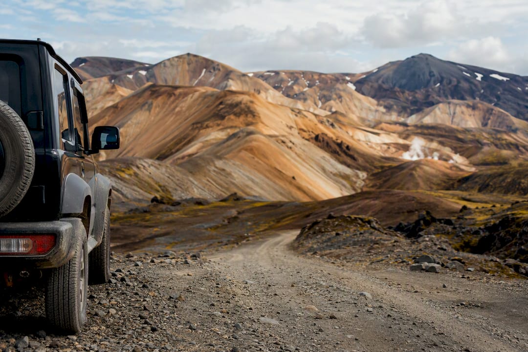
Fjallabak Nature Reserve is a highland wilderness centered on Landmannalaugar, prized for its rhyolite mountains and the multi-day Laugavegur Trail, and it opens to regular travel only in summer. Getting there means a 4x4 on the F-roads or a seat on a highland bus, since the terrain closes down for winter and the ground itself is too fragile for careless driving. Before you commit to a date, do three things:
- Check the current F-road status for F208, F225, and F26.
- Confirm your rental agreement actually permits Highland and F-road driving.
- Reserve parking or a bus seat at Landmannalaugar if you’re visiting during peak weeks.
Key Takeaways
Fjallabak Nature Reserve rewards hikers who treat summer-only access, F-road conditions, and Landmannalaugar’s fragile terrain as trip-planning filters, not afterthoughts.
| Point | Details |
|---|---|
| Summer-only access | Plan visits between late June and early September; the reserve is effectively closed the rest of the year. |
| 4x4 and F-road checks | Confirm your rental permits F208, F225, and F26 before you drive, since many standard rentals exclude them. |
| Landmannalaugar is the gateway | Use it as your base for hot springs and day hikes, but the wider reserve holds the real solitude. |
| Laugavegur is the signature trek | Budget four days for the roughly 55-kilometer route between Landmannalaugar and Þórsmörk. |
| Leave no trace matters here | Slow soil recovery means off-trail driving or camping causes damage that lasts for decades. |
Table of Contents
- Fjallabak Nature Reserve Quick Facts
- What Makes the Fjallabak Landscape Unique
- Why Does Fjallabak Have Such Colorful Mountains?
- What Are the Best Hikes in Fjallabak?
- How Do You Get to Fjallabak Nature Reserve?
- Where Can You Sleep in Fjallabak?
- How Do You Plan for Weather and Safety in Fjallabak?
- What Are the Rules for Visiting Fjallabak?
- Sample Itineraries for Visiting Fjallabak
- A Guide’s Take on Visiting Fjallabak Responsibly
- Where to Check Fjallabak Road and Trail Status
- Frequently Asked Questions
- Sources
Fjallabak Nature Reserve Quick Facts
The reserve sits mostly above 500 meters in elevation and covers roughly 44,600 to 47,000 hectares, protected since 1979. July is the warmest month with mild temperatures suitable for visiting.
- Access roads: F208, F225, and F26, linking Landmannalaugar and Hrafntinnusker
- Season: late June through early September, weather permitting
- Infrastructure: summer rangers, huts, and campsites, with parking bookings recommended at busy trailheads
What Makes the Fjallabak Landscape Unique
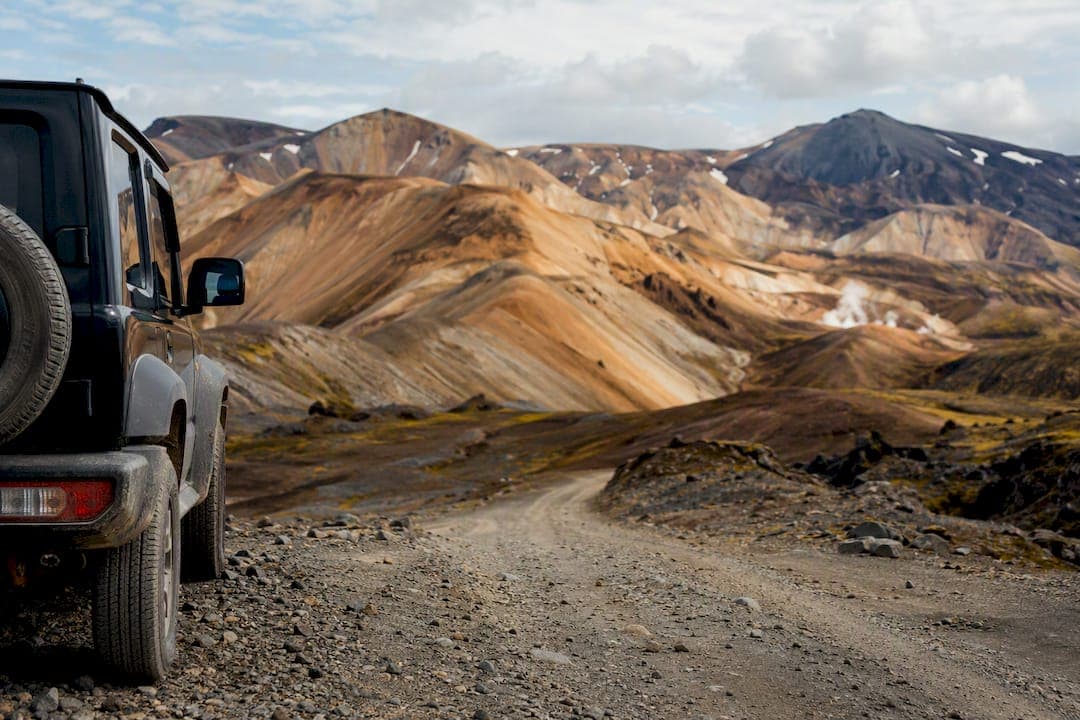
Rhyolite peaks in shades of gold, rust, and green sit alongside black lava fields, steaming geothermal valleys, crater lakes, and braided glacial rivers. It’s one of the few places in Iceland where you can walk through four distinct landscapes in a single afternoon.
Landmannalaugar functions as the main visitor base camp, with its natural hot spring and campsite drawing the bulk of day-trippers. But the reserve stretches far beyond that one valley, and most of its solitude lives in the terrain you only reach by driving further or hiking longer. Places worth knowing before you plan a route:
- Landmannalaugar, the geothermal hub and trailhead for day hikes and the Laugavegur Trail
- Þórsmörk, a forested valley reachable by the full multi-day trek or a separate F-road approach
- Torfajökull area, the volcanic system behind the reserve’s color and geothermal activity
Why Does Fjallabak Have Such Colorful Mountains?
Torfajökull is a central volcano system that created Iceland’s largest rhyolite and geothermal area, and that combination of mineral-rich rock and geothermal heat is what paints the hillsides in reds, yellows, and greens you won’t see anywhere else on the Ring Road. The geothermal zone also produces mudpots, fumaroles, and hot springs that support rare habitat types found nowhere else in Iceland.
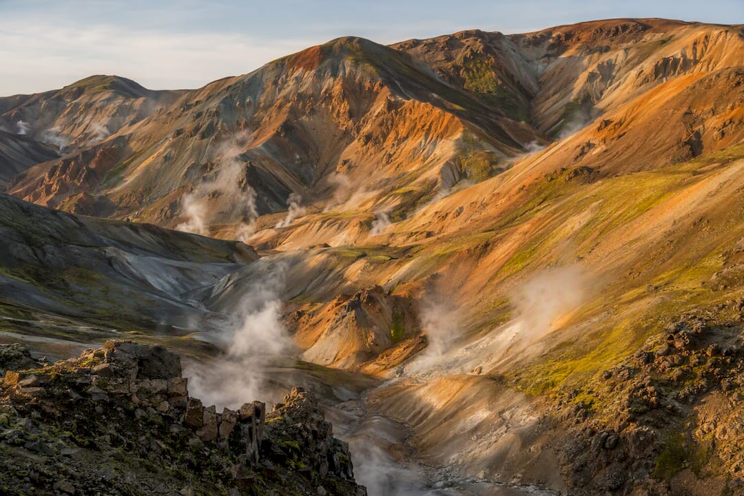
That beauty comes with a catch. Soil formation in this climate is achingly slow, and the growing season is short, so a single set of tire tracks across moss or gravel can scar the ground for decades. That’s the real reason the rules here are strict, not bureaucratic caution.
July typically features cool temperatures, and frost can occur at any time of year, illustrating the brief growing season and sensitive environment.
What Are the Best Hikes in Fjallabak?
The Laugavegur Trail is the reserve’s signature route: a roughly 55-kilometer trek from Landmannalaugar to Þórsmörk, usually broken into four days with overnight huts or camping along the way. AllTrails lists close to 28 trails across the reserve, with community ratings that consistently flag Laugavegur as challenging but achievable for fit hikers with proper gear.
If four days isn’t realistic, day hikes from Landmannalaugar deliver plenty:
- Bláhnúkur, a steep 2 to 3 hour round trip up a striking black rhyolite peak
- Brennisteinsalda, a 3 to 4 hour loop through sulfur vents and rainbow slopes
- Landmannalaugar loop, an easy 1 to 2 hour walk for a first taste of the terrain
Beyond the trails, build a driving day around Ljótipollur, a red crater lake, Frostastaðavatn, a still glacial lake near Landmannalaugar, and the Bláhylur and Hnausapollur craters. Þórsmörk itself is only reachable when river and road conditions cooperate.
How Do You Get to Fjallabak Nature Reserve?
F208 and F225 are the main gateways, connecting through F26 toward the wider Highlands network. Every one of these routes demands a genuine 4x4, and many standard rental agreements explicitly exclude F-roads, which can void your insurance the moment something goes wrong.
If self-driving feels like too much risk, highland buses and guided day tours run from Reykjavík and the South Coast throughout summer, and some trailheads now pilot advance parking bookings during peak season.
Pro Tip: Check Vegagerdin’s road status page and the SafeTravel alerts every single morning before you leave, not the night before. River levels and road conditions shift fast enough that yesterday’s report is already outdated.
Carry more fuel than you think you need, plus food and warm layers in case a closed river crossing or a washed-out section forces you to backtrack and take a longer route around.
Where Can You Sleep in Fjallabak?
Landmannalaugar has the reserve’s main supervised campsite, and staffed huts sit at Landmannahellir and Hrafntinnusker during summer. Wild camping outside these designated spots is restricted through most of the reserve, which keeps foot and tent traffic concentrated where the ground can handle it.
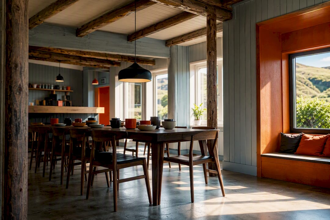
If you’d rather sleep somewhere with real beds and a hot shower before or after your highland push, staging from a South Coast base works well. Fox Hostel sits about 35 minutes east of Vík in a converted Icelandic barn, with flexible bookings for solo travelers or full room buyouts for groups, plus a communal kitchen for restocking supplies before you head into the Highlands.
How Do You Plan for Weather and Safety in Fjallabak?
Weather here turns fast, and that 7 to 8°C July average can drop toward frost with little warning. Pack for four seasons in one day:
- Waterproof jacket and pants, plus insulating layers underneath
- A physical map and compass, not just a phone app
- Charged phone, backup power, emergency shelter, and basic first-aid
- Extra food and caution at any unmarked river crossing
Relying only on GPS apps in the Highlands is risky; official road reports and SafeTravel alerts catch closures and river-level changes that mapping apps miss entirely.
Pro Tip: Set a conservative turnaround time before you start hiking, and actually stick to it. If a river crossing looks too high or a route looks impassable, turn back rather than testing your luck. It’s a lot easier to try again tomorrow than to get stuck overnight in the wrong gear.
What Are the Rules for Visiting Fjallabak?
Rangers are direct about the fragility here: no off-road driving, no building cairns, no bathing in unmarked geothermal pools, and pack out everything you bring in.
Soil recovers slowly in this climate, so a shortcut off the trail or a tire track across open ground can outlast your own memory of the trip. Stick to marked paths, use official campsites and huts, and follow ranger instructions when they’re on site.
Sample Itineraries for Visiting Fjallabak
One focused day: drive or bus to Landmannalaugar, hike Bláhnúkur or the short loop, soak in the hot spring, and head back before evening.
Three-day reserve route: camp or hut-hop between Landmannalaugar and nearby craters and lakes, building in a spare day for weather or river-level delays.
Full Laugavegur trek: four days from Landmannalaugar to Þórsmörk, staying in huts or camping, with a bus or shuttle arranged at both ends since it’s a one-way route.
A Guide’s Take on Visiting Fjallabak Responsibly
Landmannalaugar is a fine anchor, but the reserve pays off most for people who give it real time and respect the day’s actual conditions instead of forcing a plan. The rule worth borrowing: only commit to a wider reserve route when road status is genuinely good that morning, not just forecast to improve. A shorter, well-timed day beats a longer one spent stuck at a closed river.
Where to Check Fjallabak Road and Trail Status
For the morning of departure, check Vegagerdin’s road status and SafeTravel alerts before anything else, since river levels and closures shift daily. AllTrails offers useful length and difficulty data for specific Fjallabak routes, and if you’re stacking Fjallabak with other South Coast stops, scenic spots near Vík are worth folding into the same trip.
Frequently Asked Questions
Is Fjallabak Nature Reserve open year-round? No. It’s effectively a summer destination, open roughly late June through early September depending on snowmelt and road conditions, with July averaging 7 to 8°C.
Do I need a 4x4 to visit Fjallabak? Yes, for self-driving. The access roads, F208, F225, and F26, require a genuine 4x4, and standard rental cars are typically barred from F-roads by their own rental agreement.
How long is the Laugavegur Trail? About 55 kilometers, usually hiked over four days from Landmannalaugar to Þórsmörk, with huts and campsites along the route.
Can I visit Fjallabak without a car? Yes. Highland buses and guided day tours run from Reykjavík and South Coast towns throughout summer, which sidesteps the F-road and rental restrictions entirely.
Is wild camping allowed in Fjallabak? It’s restricted through most of the reserve. Stick to the official campsites at Landmannalaugar or the supervised huts at Landmannahellir and Hrafntinnusker.
Sources
- Fjallabak Nature Reserve | Visit South Iceland
- Fjallabak Nature Reserve - NAT
- Laugavegur Trail: Landmannalaugar - Þórsmörk — AllTrails
- Fjallabak Guide: Highland Reserve and F-Road Planning — ThingsToDoInIceland
Recommended
- Why Iceland is perfect for nature lovers | Fox Hostel – South Iceland
- Visiting Kirkjubæjarklaustur: Your 2026 Tourist Guide | Fox Hostel – South Iceland
- Glacier Hiking Tips: Stay Safe and Prepared | Fox Hostel – South Iceland
- Waterfall Exploration Tips for Safe, Stunning Visits | Fox Hostel – South Iceland