3.8 Mile Bleaklow Plane Wreck Walk: Safety, Routes, Respect
3.8 Mile Bleaklow Plane Wreck Walk: Safety, Routes, Respect
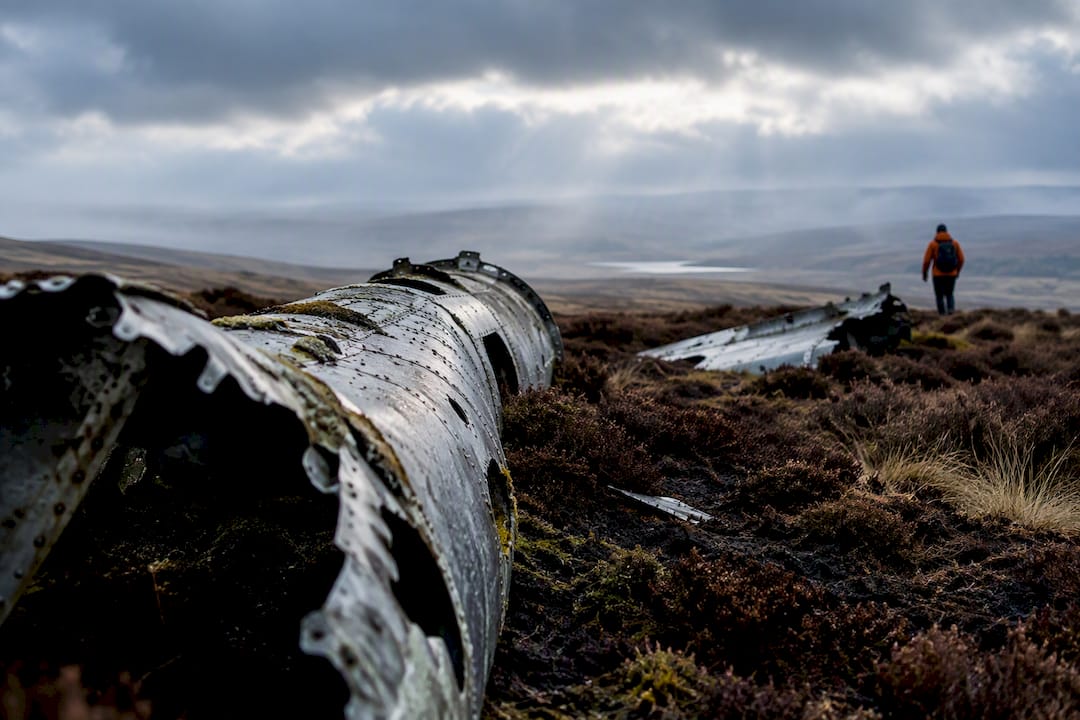
Yes, the wreck most hikers mean when they talk about a Peak District plane wreck walk is the Bleaklow B29 Superfortress. You can reach it two ways: a short circular from Snake Summit (roughly 1.5 to 3 hours) or the far tougher Torside approach along the Pennine Way (4 hours or more). Pick the short route unless you’re an experienced, well-equipped hill walker, and never attempt either in poor visibility without a map and compass.
TL;DR:
- The short route from Snake Summit covers about 3.7 miles with approximately 158 meters of ascent and takes 1.5 to 2 hours in good conditions.
- The longer Torside route exceeds 10 miles with steep, featureless terrain, requiring advanced navigation skills and at least 4 hours to complete.
- Navigating the transition off the Pennine Way onto unmarked moorland is the main risk, especially in poor visibility, and requires careful preparation and backup tools.
- Visitors must treat the wreck site respectfully as a memorial and avoid climbing on debris or taking pieces as souvenirs to preserve the site.
- Proper safety gear includes a map, compass, waterproofs, extra layers, and a downloaded offline map, with deemed importance on daylight scheduling and informing someone of your route.
Table of Contents
- Short Circular or Long Torside Route: Which One Fits You?
- Walking to the Crash Site From Snake Summit
- The Long Route: Why Torside Is Not for Beginners
- Navigation and Safety Checklist for Moorland Plane-Wreck Walks
- Where to Park and What Could Go Wrong
- Respectful Visiting: This Is a War Memorial, Not a Photo Op
- Why a Guided Walk Can Be Worth the Cost
- What Wildlife and Landscape Features You’ll Pass Along the Way
- Toilets, Food, and Other Facilities Near the Walk
- Minimizing Your Impact on a Fragile Moorland Environment
- The Crash That Created This Memorial Walk
- The Real Lesson From Bleaklow’s Wreckage
- Sources
- FAQ
Short Circular or Long Torside Route: Which One Fits You?
Most walkers should default to the short circular from Snake Summit. It runs about 3.6 to 3.8 miles round trip with roughly 150 to 160 meters of ascent, and takes 1.5 to 3 hours depending on ground conditions.
The Torside/Pennine Way option is a different animal entirely. It is closer to 10 miles, steep, exposed, with no signposts across most of it. The National Park Authority rates it at a minimum of 4 hours and says it’s suited only to experienced, well-equipped hill walkers.
Before choosing, run through this:
- How many daylight hours do you actually have left?
- Is the forecast clear, or is cloud due to roll in by afternoon?
- Does everyone in your group have moorland navigation experience?
- Is your party small enough to move at a consistent pace across boggy ground?
Pro Tip: If your group has mixed fitness or navigation experience, default to the short circular every time. The Torside route punishes indecision far more than the shorter option does.
Walking to the Crash Site From Snake Summit
The short circular starts at Snake Summit, where you pick up the Pennine Way heading north. The path is solid and well trodden for the first stretch, then it peels off across open moorland, and that’s where things get interesting. There’s no clear trail once you leave the Pennine Way. You’re following peat groughs and sheep tracks toward Higher Shelf Stones, and in poor visibility that transition point is exactly where walkers lose their bearings.
A commonly cited version of this route runs 3.7 to 3.8 miles with about 158 meters of ascent, taking 1.5 to 2 hours in good conditions. Add time if the ground is wet, which is most of the year.
Three moments matter most on this walk:
- Leaving the Pennine Way. This is the single point where most navigation errors start. Note the grid reference or landmark before you step off-path.
- Crossing the peat groughs. These deep, eroded channels can be disorienting in fog and genuinely difficult after rain.
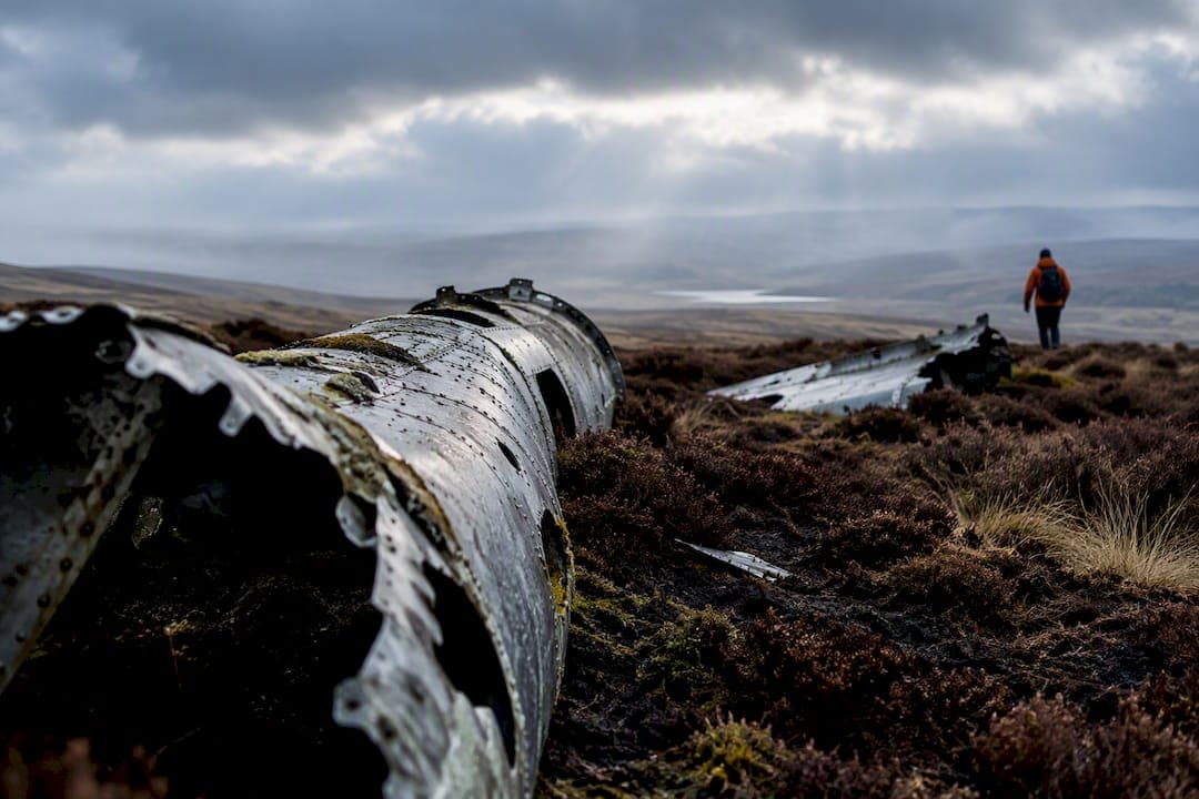
- Reaching Higher Shelf Stones and the wreck. The trig point at Higher Shelf Stones sits close to the debris field, and the memorial plaque marks the site itself.
The National Park Authority notes the site sits at least 2 miles from the nearest parking, which is why daylight margin matters even on the “short” option. Carry a downloaded GPX track and offline maps as backup, but treat them as a supplement to paper navigation, not a replacement.
Once you’re there, look and don’t touch. This is a memorial. Climbing on the wreckage or pocketing a piece of fuselage isn’t a souvenir, it’s disturbing a site where 13 men died.
The Long Route: Why Torside Is Not for Beginners
The Torside approach follows a longer stretch of the Pennine Way before cutting across Bleaklow’s higher ground toward the crash site, and it demands a different level of preparation than the short circular. At roughly 10 miles with steep, rough terrain and no signposts, it’s a route where a wrong turn can add hours rather than minutes.
The gap between the two options isn’t just distance. Torside puts you on exposed moorland for far longer, which means more time where weather can turn and more ground where a misread compass bearing compounds. The Park Authority’s guidance pegs it at 4 hours minimum for walkers who already have hill experience and proper kit. That’s not a soft warning, it’s a floor.
Practical advice for anyone still set on this route:
- Only start in settled weather with a clear forecast for the full day, not just the morning — for a detailed take on planning trips in remote mountain areas, see remote ski travel planning.
- Carry full hillwalking kit: waterproofs, spare warm layers, food, water, and a headtorch even if you expect to finish before dark.
- Set a hard turnaround time before you leave, and stick to it regardless of how close you feel to the wreck.
- If you’re inexperienced on featureless moorland, a guided walk removes most of the risk that makes this route dangerous in the first place.
Treat Torside as a hillwalking day out, not a long stroll with a photo stop at the end.
Navigation and Safety Checklist for Moorland Plane-Wreck Walks
Bleaklow’s real hazard isn’t the mileage, it’s the transition from a defined path onto unmarked peat moor, where landmarks disappear and weather shifts fast. Pack for that reality, not for a pleasant afternoon.
Kit worth carrying every time:
- OS Explorer map (paper) and a compass you know how to use.
- Waterproof jacket and trousers, plus a warm layer even in summer.
- Spare hat and gloves, food, and more water than you think you need.
- Headtorch and a basic first-aid kit.
On the digital side, download a GPX track and an offline mapping app before you leave home, since phone signal across Bleaklow is patchy at best. Treat these tools as backup to map-and-compass skills, never a substitute.
Three planning habits prevent most of the trouble on this walk: build in a daylight margin rather than timing your arrival for dusk, avoid starting in the early afternoon during autumn or winter, and tell someone your route and expected return time. If something goes wrong, call 999 or 112 and ask for mountain rescue.
Pro Tip: If you know your grid reference or what3words location before you set off, share it with whoever you’ve told your plan to. It cuts search time dramatically if you need to call for help.
Where to Park and What Could Go Wrong
Snake Summit parking is limited and tight, and rangers do enforce the yellow lines nearby, so don’t gamble on squeezing in illegally. The alternative is the small Doctor’s Gate Culvert car park, which holds about six cars and adds roughly 500 meters to your walk each way.
A few practical notes:
- Arrive early on weekends and holidays. Both car parks fill fast, especially in summer.
- Have a backup plan for where to turn around if Snake Summit is full when you arrive.
- Open-access moorland can be temporarily closed for land management or fire risk, so check before you drive out.
- Take everything you brought back out with you. There are no bins on the moor.
Ignoring parking restrictions here doesn’t just risk a ticket. It risks blocking narrow roads that emergency vehicles sometimes need.
Respectful Visiting: This Is a War Memorial, Not a Photo Op
The wreck marks where 13 crew members died when the RB-29A Superfortress ‘Over Exposed’ crashed in November 1948. You’ll find a plaque, and often poppies or small crosses left by visitors, scattered near the debris field.
Treat the ground the way you’d treat any memorial:
- Do not climb on the wreckage, however tempting the photo looks.
- Do not remove pieces of the aircraft as souvenirs. The site has already lost material to decades of visitors doing exactly that.
- Avoid leaving mementoes that damage the ground or attract litter, and stick to existing paths where possible to limit trampling.
- Follow any temporary closure signage from the Park Authority without exception.
If you see someone damaging the site or removing parts, report it to the Peak District National Park Authority. Thirteen men lost their lives on that moor, and the site’s condition depends entirely on how visitors choose to behave when nobody’s watching.
Why a Guided Walk Can Be Worth the Cost
A good guide does three things a map can’t: reads the ground in real time, makes weather calls before conditions turn dangerous, and fills in the historical context that turns a walk into something more than a checklist. On featureless moorland, that route-finding and judgment matters more than most walkers expect until they’re standing in fog with no clear path.
Book a guide if visibility is forecast to be poor, your group has mixed navigation experience, or you’re planning a winter visit when daylight is short and conditions change fast.
Before you book, check a few things:
- Does the guide or company carry current first-aid training?
- Do they run a documented risk assessment for the specific route?
- Do they cap group size, and what’s their cancellation policy if weather turns bad?
Pro Tip: Ask a potential guide what their turnaround criteria are before the walk starts. A guide who can’t give you a clear answer probably doesn’t have one.
What Wildlife and Landscape Features You’ll Pass Along the Way
Bleaklow’s moorland isn’t just a backdrop for the wreck, it’s one of the Peak District’s more distinctive upland habitats. Watch for red grouse, which explode out of the heather with a startling clatter if you get too close, and listen for the curlew’s rising call, especially in spring and early summer when they’re nesting on the open moor.
Mountain hares turn up here too, particularly in the higher, more remote stretches away from the main paths, though sightings are inconsistent and depend heavily on season. Merlin, the UK’s smallest falcon, hunts over this ground and is worth watching for if you’ve got a pair of binoculars and a few spare minutes.
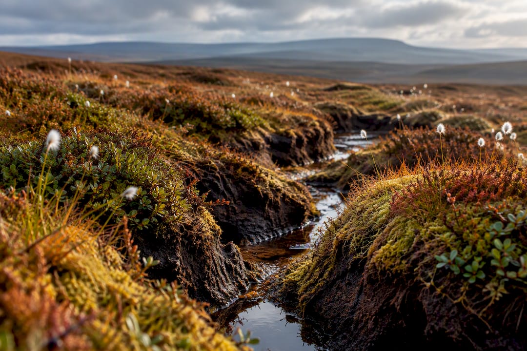
The landscape itself tells its own story. The peat groughs you’ll navigate around aren’t just obstacles, they’re evidence of centuries of erosion on ground that was once far more stable. Sphagnum moss, cotton grass, and bilberry dominate the exposed sections, and in autumn the moor turns a deep russet that’s genuinely worth the slower pace.
Keep dogs on leads through nesting season, typically March through July, since ground-nesting birds like curlew and golden plover are especially vulnerable to disturbance during that window. None of this wildlife should slow your navigation planning, but it’s worth building in a few minutes to actually look up from the map.
Toilets, Food, and Other Facilities Near the Walk
There are no facilities at either Snake Summit or Doctor’s Gate Culvert, so plan accordingly before you set off. No toilets, no shop, no phone signal you can rely on.
The nearest reliable amenities sit in Glossop and Hayfield, both a short drive from the trailheads, with pubs, cafés, and public toilets. If you’re coming from the Sheffield side, Hathersage offers similar options and makes a reasonable base for an early start.
Fill up on water and food before you leave the car, not after. Once you’re on the moor, the nearest facility is wherever you parked, which for the Torside route could be hours away.
Minimizing Your Impact on a Fragile Moorland Environment
Peat moorland is slow to recover and quick to scar. A single set of boot prints across wet ground can turn into a visible path within a season if enough people follow the same shortcut, which is exactly how unofficial trails spread across Bleaklow’s open sections.
Stick to established paths wherever they exist, even when the direct line looks faster. Widening a boggy section by walking around its edge instead of through it does more long-term damage than getting your boots wet.
Pack out everything you bring in, food wrappers included, and resist the urge to build cairns or leave trail markers of your own. The moor doesn’t need your help finding the way, and stacked stones disrupt both the landscape and the navigation cues other walkers rely on.
If you’re walking with a group larger than four or five, consider splitting into smaller clusters on the narrower sections. It spreads foot traffic and reduces the erosion pressure on any single line across the peat.
The Crash That Created This Memorial Walk
The wreck at the heart of this walk is what remains of the RB-29A Superfortress named ‘Over Exposed,’ which crashed on the moor in November 1948, killing all 13 crew members aboard. The aircraft came down in poor weather, a detail that still resonates given how often modern walkers underestimate the same conditions on the same ground.
Wreckage remains scattered across a wide area rather than concentrated in one tidy site, a reflection of how the aircraft broke apart on impact. That spread is part of why the location functions less like a single monument and more like a memorial landscape, one you walk through rather than simply visit.
The crash is one of several aircraft losses across the Dark Peak during and after World War II, a grim reminder of how often this high, weather-exposed terrain caught pilots off guard decades before hikers started making the same walk for very different reasons.
The Real Lesson From Bleaklow’s Wreckage
Most advice about this walk fixates on mileage, as if 3.8 miles automatically means “easy.” It doesn’t. The research behind this guide points to something else entirely: the danger sits in that unmarked transition off the Pennine Way, not in the total distance covered. A short walk with poor navigation can go wrong faster than a long walk with good judgment.
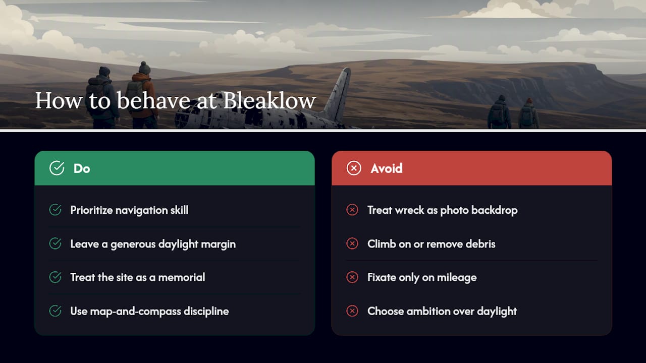
Conventional guides also underplay the memorial aspect, treating the wreck like scenery instead of a site where 13 men died. That framing shapes behavior. Visitors who see it as a photo backdrop climb on debris and take pieces home. Visitors who see it as a memorial don’t.
Prioritize navigation skill over gear, daylight margin over ambition, and respect over souvenirs. If you’re heading north through the Peak District as part of a longer road trip, the same map-and-compass discipline and layering habits apply wherever the terrain turns remote, including the kind of glacier hiking preparation Fox Hostel covers for travelers heading to South Iceland. Get the fundamentals right here, and they transfer everywhere else you walk.
— Siggi
Sources
Bookmark these before setting out, since conditions and access rules change:
- Bleaklow - B29 bomber crash site
- Higher Shelf Stones Short Walk (+ Bleaklow Plane Crash Site) | Peak District Walks
- How to stay safe when hiking - Peak District Mosaic
FAQ
How Long Is the Walk to the B29 Crash Site?
The short circular from Snake Summit runs about 3.6 to 3.8 miles round trip and takes 1.5 to 3 hours depending on conditions. The longer Torside approach is closer to 10 miles and takes at least 4 hours for experienced hill walkers.
Where Is the 7 Hour Plane Crash Trail?
There’s no single official long-duration trail at Bleaklow. Accounts vary depending on pace and stops, but the Park Authority’s own guidance lists the long Torside route as a minimum 4-hour walk.
Did They Find Human Remains From Flight 93?
That question refers to a different incident entirely, the crash near Shanksville, Pennsylvania, which has no connection to the Bleaklow B29 site in the Peak District. This article covers the 1948 Superfortress crash in England, not crashes elsewhere.
How Did Someone Survive a 33,000 Foot Fall?
This question also refers to a separate historical event unrelated to the Bleaklow site. No fall of that kind is associated with the 1948 B29 crash covered in this guide, which killed all 13 crew members on board.