Iceland's Ring Road Itinerary: 7 Days, Full Loop
Iceland’s Ring Road Itinerary: 7 Days, Full Loop
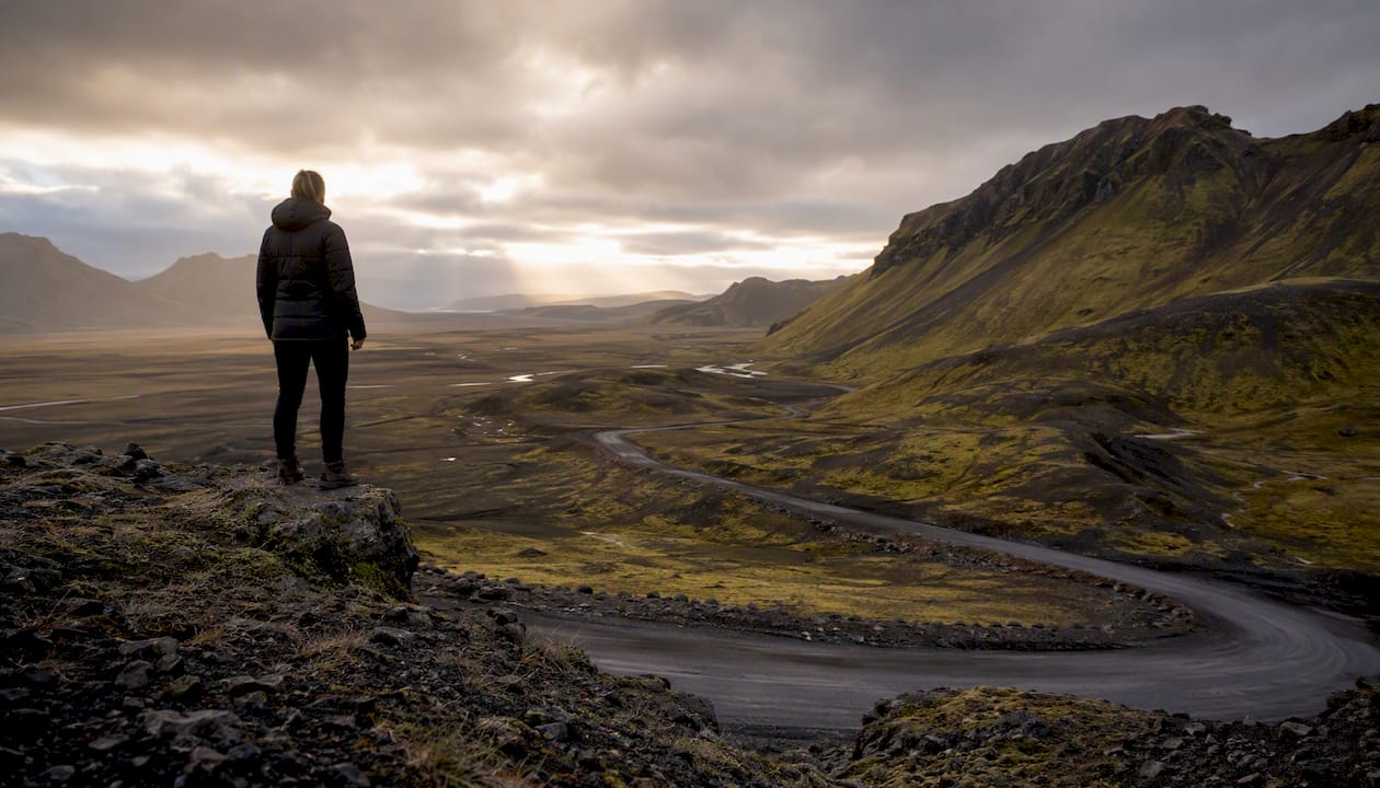
Seven days is enough to complete Iceland’s Ring Road, but only if you accept a fast, purposeful pace. The full Route 1 loop runs about the length commonly quoted for the Ring Road loop, and with common detours you’ll cover around 1,400 km across the week. Anti-clockwise from Reykjavík is the recommended direction for a 7-day schedule: it puts the South Coast’s dense cluster of waterfalls, black sand beaches, and glacier lagoons on Days 1–3, when you’re freshest and the infrastructure is most forgiving.
Here’s the shape of the week:
- Day 1: Reykjavík → Vík area (approx. 3–4 hrs driving, ~190 km)
- Day 2: Vík area → Höfn (approx. 3.5–4.5 hrs driving, ~250 km)
- Day 3: Höfn → Egilsstaðir (approx. 3–4 hrs driving, ~200 km)
- Day 4: Egilsstaðir → Mývatn (approx. 2.5–3 hrs driving, ~170 km)
- Day 5: Mývatn → Akureyri (approx. 1–1.5 hrs driving, ~100 km)
- Day 6: Akureyri → Borgarnes / Snæfellsnes area (approx. 3.5–4 hrs driving, ~240 km)
- Day 7: Borgarnes area → Reykjavík (approx. 1.5–2 hrs driving, ~75 km)
Total pure driving across the week: about 17 to 22 hours. That leaves real time at each stop, provided you start early and skip the optional detours that eat entire afternoons.
Key Takeaways
A 7-day Ring Road itinerary is achievable on Route 1’s roughly 1,322 km loop, but only with an anti-clockwise direction, early daily starts, and South Coast accommodation booked well in advance.
| Point | Details |
|---|---|
| Direction matters | Drive anti-clockwise to tackle the South Coast’s dense highlights while you’re freshest. |
| Book early | South Coast beds near Vík fill 6–8 weeks ahead in summer; car rentals climb in price from April. |
| Budget realistically | Shared self-drive costs run roughly USD 1,200–2,400 per person; self-catering cuts food costs significantly. |
| Check conditions daily | Consult road.is and vedur.is every morning; eastern sections can close with little warning in winter. |
| Use your base strategically | Staying east of Vík at a place like Fox Hostel puts you 90 minutes closer to Jökulsárlón for an early Day 2 start. |
Table of Contents
- What do you need to sort out before you leave?
- Your day-by-day Ring Road itinerary for 7 days
- How does the season change your 7-day plan?
- What does a 7-day Ring Road trip actually cost?
- What should you pack for this drive?
- Driving safety on the Ring Road: what you need to know
- Why Fox Hostel works as your South Coast base
- Route map and printable planning tools
- A local perspective on the 7-day loop
- Sources
What do you need to sort out before you leave?
Getting the logistics right before you land saves you from the two most common Ring Road disasters: the wrong car and the wrong insurance.
Flights and car pickup
Fly into Keflavík International Airport (KEF), which sits about 50 km southwest of Reykjavík. Pick up your rental car at the airport on arrival day and plan to return it there on Day 7. Most rental desks open early, so a morning arrival works well. If you land late, spend your first night near Reykjavík and start the loop properly on Day 1 morning.
Which direction to drive
Anti-clockwise is the right call for a 7-day Ring Road itinerary. The South Coast packs the highest density of iconic stops per kilometer. Tackling it first means you’re not rushing Jökulsárlón or Reynisfjara on a tired Day 6. The East Fjords and North, which are quieter and more spread out, come later in the week when the pace naturally slows.
Vehicle choice
A standard 2WD car handles Route 1 in summer without any issues. You only need a 4×4 if you plan to drive F-roads into the highlands, and a tight 7-day loop doesn’t include them. In winter, a 4×4 with winter tires is strongly advisable for the eastern and northern sections, where road conditions can deteriorate fast.
Insurance checklist
Iceland’s rental insurance landscape is genuinely confusing, and underestimating coverage gaps is one of the most common and costly traveler mistakes. Before you sign anything, confirm:
- Collision Damage Waiver (CDW): usually included, but check the excess amount
- Gravel Protection: covers windshield and bodywork from loose gravel on unpaved roads
- Sand and Ash Protection (SAAP): covers damage from wind-blown volcanic sand, common on the South Coast
- Tire and Rim Protection: often excluded by default
Pro Tip: Get the full insurance bundle in writing before you arrive. Wind and sand damage can strip paint overnight in exposed coastal areas, and standard CDW won’t cover it. Paying an extra €15–25 per day for full coverage is far cheaper than a repair bill.
Must-book items and planning bookmarks
Book your car and the three or four most popular accommodation nights before anything else. Vík-area beds in summer sell out weeks ahead. Save these two links now:
- Road: live road condition updates, closures, and F-road status
- Vedur: Iceland’s official weather service, including wind alerts
Your day-by-day Ring Road itinerary for 7 days
The table below gives the structural skeleton. The detail follows underneath.
| Day | Start | End | Est. Drive Time | Approx. km |
|---|---|---|---|---|
| 1 | Reykjavík | Vík area | 3–4 hrs | ~190 km |
| 2 | Vík area | Höfn | 3.5–4.5 hrs | ~250 km |
| 3 | Höfn | Egilsstaðir | 3–4 hrs | ~200 km |
| 4 | Egilsstaðir | Mývatn | 2.5–3 hrs | ~170 km |
| 5 | Mývatn | Akureyri | 1–1.5 hrs | ~100 km |
| 6 | Akureyri | Borgarnes area | 3.5–4 hrs | ~240 km |
| 7 | Borgarnes area | Reykjavík | 1.5–2 hrs | ~75 km |
Day 1: Reykjavík to Vík area
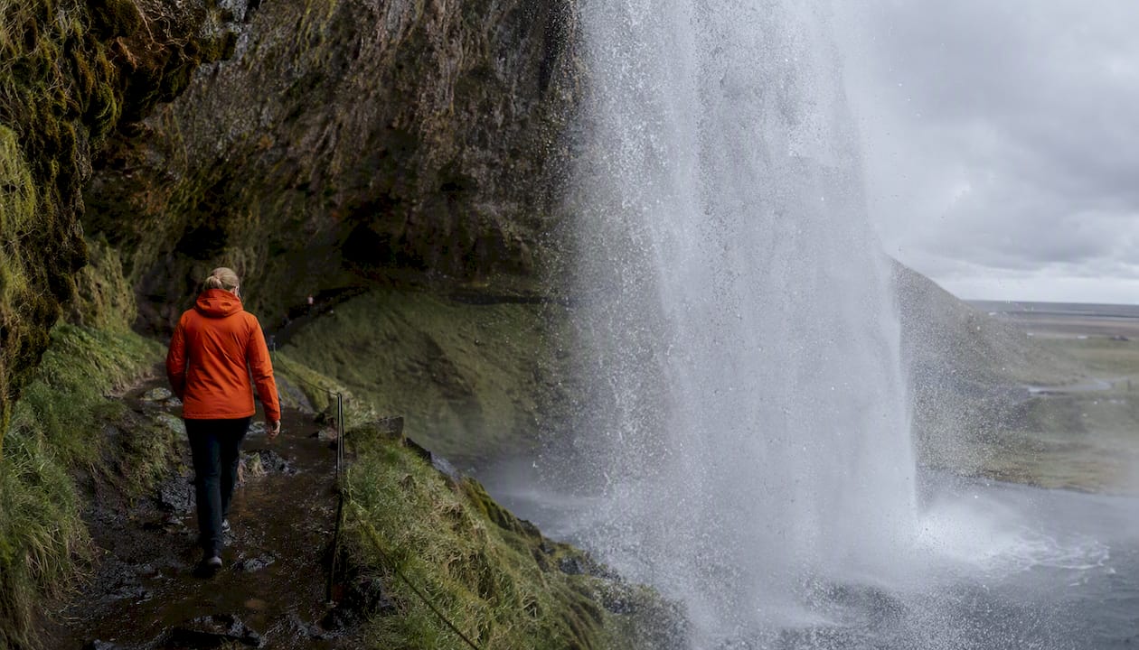
Leave Reykjavík by 8:00 AM. Your first stop is Seljalandsfoss, a waterfall you can walk behind on a narrow path. It’s wet and slippery, so waterproof gear matters here. Twenty minutes east, Skógafoss is wider and more dramatic. Climb the staircase beside it for a view down the river valley that most visitors skip.
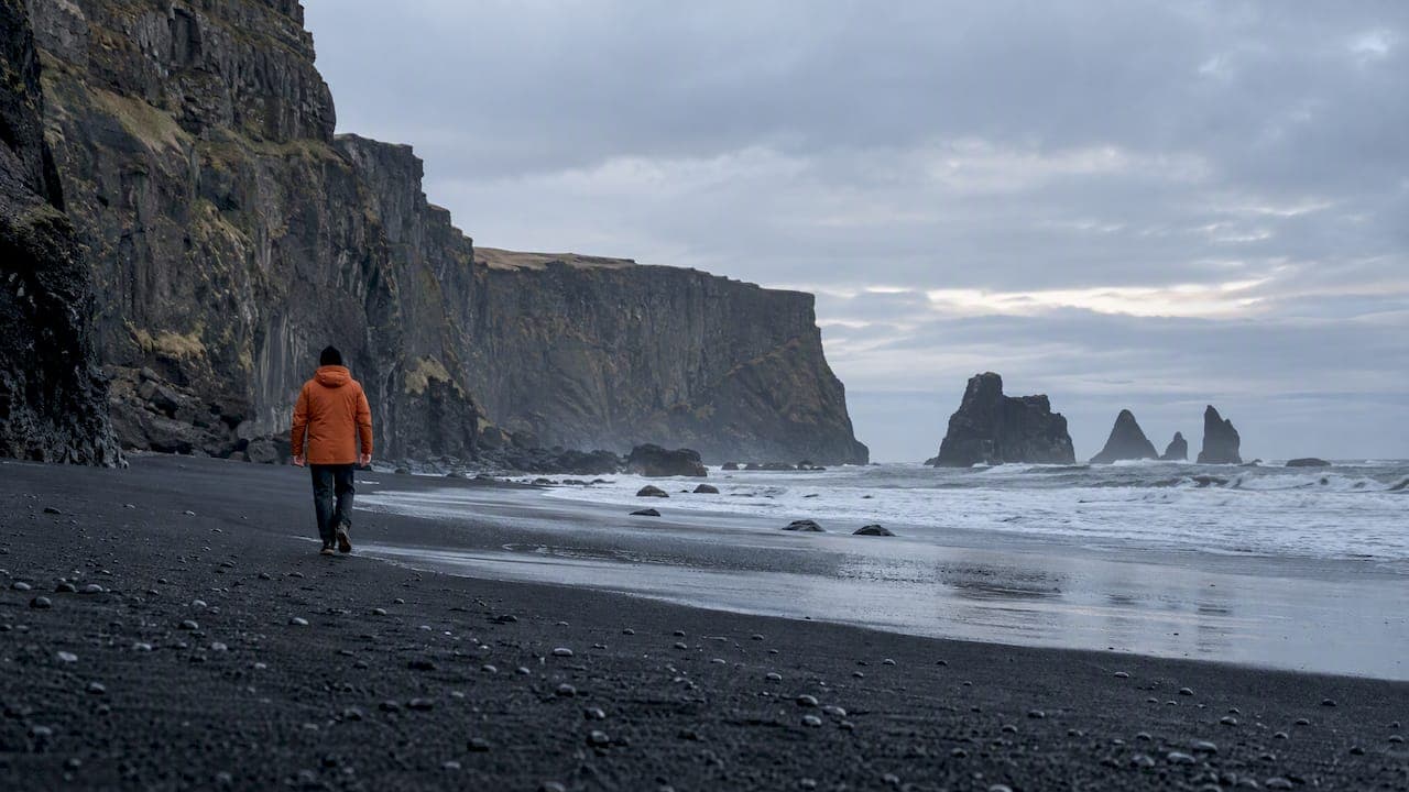
From Skógafoss, continue to Reynisfjara Black Sand Beach near Vík. The sneaker waves here are genuinely dangerous. Stay behind the safety markers and never turn your back on the water. The basalt column formations and sea stacks are worth 45–60 minutes.
Overnight in the Vík area. Staying just east of Vík, rather than in the village itself, gives you a head start on Day 2’s long drive to Höfn.
Optional detour: Dyrhólaey, the dramatic arch promontory southwest of Vík, adds about 30 minutes and is worth it for the coastal views. Puffins nest here from May through August.
Day 2: Vík area to Höfn
This is the longest and most rewarding driving day. Leave by 8:00 AM.
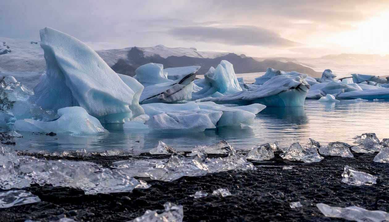
The first major stop is Skaftafell within Vatnajökull National Park, where a short hike to Svartifoss waterfall (about 90 minutes round trip) passes basalt columns that look almost architectural. From Skaftafell, it’s roughly an hour to Jökulsárlón Glacier Lagoon. Allow at least 60–90 minutes here: the blue-white icebergs drifting toward the sea are unlike anything else in Europe. Cross the road to Diamond Beach, where ice chunks wash up on black sand. A glacier boat tour on the lagoon adds another 45 minutes and is one of the few guided add-ons that genuinely earns its price.
Overnight in Höfn, a small fishing town with good seafood restaurants. Höfn’s langoustine is locally famous.
Day 3: Höfn to Egilsstaðir
The East Fjords section is the quietest stretch of the whole loop. Services are sparse, so fuel up in Höfn before you leave. The road winds through a series of fjords with steep walls dropping into dark water. It’s slow-going in places, but the scenery is unlike the South Coast’s wide-open plains.
Egilsstaðir is the main service hub for the east. If you have time, the 30-minute detour to Seyðisfjörður is worth it: a blue-painted village at the end of a fjord, with a ferry connection to Europe and a genuinely photogenic main street. Egilsstaðir and Seyðisfjörður are the practical overnight hubs for this section, with the widest accommodation and dining options in the east.
Overnight in Egilsstaðir.
Day 4: Egilsstaðir to Mývatn
The drive north from Egilsstaðir crosses into a different Iceland: geothermal steam vents, lava fields, and the strange lunar surface around Lake Mývatn. Key stops include:
- Námaskarð / Hverir: boiling mud pots and sulfur fumaroles right beside the road
- Dimmuborgir: a lava field with dramatic rock formations and short walking trails
- Mývatn Nature Baths: geothermal pools similar to the Blue Lagoon but far less crowded
Overnight at Mývatn. Book the Nature Baths in advance in summer.
Day 5: Mývatn to Akureyri
The shortest driving day of the trip. Use the extra time to explore Goðafoss, the Waterfall of the Gods, which sits right on Route 1 between Mývatn and Akureyri. It’s one of the most accessible major waterfalls in Iceland: park, walk two minutes, and you’re looking at a 30-meter-wide curtain of water.
Akureyri is Iceland’s second city, with a proper high street, good restaurants, and a botanical garden that somehow survives at 65°N. Spend the afternoon here. If whale-watching is on your list, Akureyri and nearby Húsavík are the best departure points in the north.
Overnight in Akureyri.
Day 6: Akureyri to Borgarnes area
A long drive west along the north coast and then south through the Hvalfjörður tunnel or over the Kjalarnes peninsula. The Snæfellsnes Peninsula is technically a detour from the direct return route, but if you’re willing to drive an extra hour, the glacier-capped volcano at its tip is extraordinary. Most travelers on a tight 7-day schedule skip Snæfellsnes and overnight near Borgarnes instead, saving energy for the final morning.
Optional detour: Hraunfossar and Barnafoss waterfalls near Reykholt add about 45 minutes off Route 1 and are far less visited than the South Coast equivalents.
Overnight near Borgarnes.
Day 7: Borgarnes area to Reykjavík
The shortest day. Borgarnes to Reykjavík is about 75 km on a fast road. Use the morning to visit the Settlement Center in Borgarnes if history interests you, or push straight to Reykjavík for a final afternoon in the city before your flight. Return the rental car at Keflavík Airport.
How does the season change your 7-day plan?
The Ring Road is a different trip in June than it is in January, and the gap matters more than most guides admit.
Summer (May–September) is the default for a reason. Daylight is essentially unlimited from late May through July: you can drive at 11:00 PM in full light, which gives you flexibility to push further or linger longer at a site. Puffins are visible at Dyrhólaey and Látrabjarg from May through August. The full loop is accessible, all services are open, and the roads are dry.
Shoulder season (April and October) offers smaller crowds and the first real aurora chances. Daylight drops to roughly 13–15 hours in April and 10–12 hours in October. Some highland roads and a few smaller services close by mid-October.
Winter (November–March) requires a fundamentally different approach. Most guides recommend adding 1–1.5 days of buffer time in winter because weather can close eastern sections without warning. A 7-day winter loop is possible but genuinely risky to plan tightly. The smarter move is a south-coast-focused plan that doesn’t depend on the eastern and northern sections staying open.
Seasonal adjustments at a glance:
- Summer: Full loop, unlimited daylight, book accommodation 6–8 weeks ahead
- Shoulder: Full loop possible, carry extra buffer days, aurora viewing likely
- Winter: Compress to south coast and north; skip East Fjords if conditions are uncertain; check Road every morning
Pro Tip: In winter or shoulder season, cut the East Fjords detour to Seyðisfjörður first. It’s the most exposed section and the one most likely to be affected by ice or closures. The core loop still works without it.
Aurora season runs roughly September through March. The North, particularly around Mývatn and Akureyri, offers some of the best viewing conditions in Iceland when skies are clear.
What does a 7-day Ring Road trip actually cost?
Most travelers on a shared self-drive 7-day loop spend between USD 1,200 and 2,400 per person packzup.com, depending on car class, accommodation tier, and how much they eat out. Here’s how that breaks down:
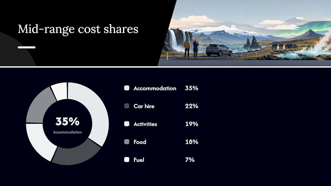
| Item | Budget Range | Mid-Range | Notes |
|---|---|---|---|
| Car hire (7 days) | USD 400 | USD 700 | Per car; split between travelers |
| Fuel (~1,400 km) | USD 180 | USD 220 | Based on a standard petrol car |
| Accommodation (7 nights) | USD 35–60/night | USD 80/night | Per person; hostel dorm vs guesthouse |
| Food (self-cater vs dining) | USD 20–30/day | USD 40/day | Per person |
| Activities (paid sites) | USD 100–200 | USD 200–400 | Glacier tours, nature baths, whale-watching |
| Total per person (shared car, 2 travelers) | ~USD 1,200 | ~USD 1,200–2,400 | Varies significantly by choices |
The biggest lever is food. Iceland’s restaurants are expensive by any standard. Travelers who self-cater using hostel kitchens cut daily food costs by 40–60% compared to eating every meal out. Supermarkets (Krónan and Bónus are the budget chains) are available in Reykjavík, Vík, Höfn, Egilsstaðir, and Akureyri.
Pro Tip: Book your car early. Summer rental prices in Iceland climb sharply from April onward, and the cheapest 2WD options sell out first. Locking in a car 8–12 weeks ahead can save USD 200–400 on the total rental cost.
For groups, buying out a full hostel room rather than booking individual beds often costs less per person than a guesthouse, and you get a private space. For a practical breakdown of how self-catering stays work on a road trip, the logistics are simpler than most travelers expect.
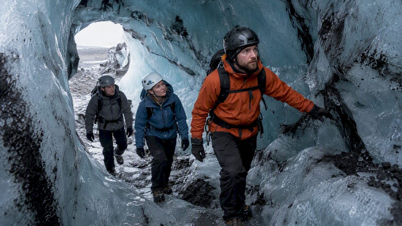
Guided glacier tours at Skaftafell or a boat tour at Jökulsárlón add USD 60–120 per person but save the time and gear cost of organizing it independently. For those two specific activities, the guided option is usually worth it.
What should you pack for this drive?
Iceland’s weather changes faster than almost anywhere in Europe. The packing list below is built for the 7-day loop specifically, not a general Iceland trip.
Clothing and layering:
- Waterproof shell jacket and waterproof trousers (non-negotiable)
- Insulated mid-layer (fleece or down jacket)
- 2–3 quick-dry base layer tops
- Warm hat, gloves, and a buff or neck gaiter
- Swimwear (for Mývatn Nature Baths and any hot pots)
Footwear:
- Waterproof hiking boots with ankle support for short trail walks
- Sandals or camp shoes for hostel use
- Crampons: only needed if you book a glacier walk, and rental crampons and glacier boots are available on-site at Skaftafell and Jökulsárlón operators
Electronics and navigation:
- Phone mount for the car dashboard
- Portable power bank (12,000 mAh minimum)
- USB car charger with multiple ports
- Download offline maps via Google Maps or Maps.me before you leave Reykjavík; coverage in the East Fjords is patchy
Practical items:
- Reusable water bottle (tap water in Iceland is excellent)
- Sunglasses with UV protection (summer glare off glaciers is intense)
- Basic first aid kit
- Cash in Icelandic króna (ISK) for the few rural spots that don’t take cards, though most do
- Snacks and a small cooler bag for long driving days between services
What to rent rather than bring: glacier boots and crampons are bulky and available from activity operators. A roof rack or luggage box is worth adding to your rental if you’re traveling with more than two large bags.
Driving safety on the Ring Road: what you need to know
Iceland’s roads are not technically difficult, but the hazards are specific and worth taking seriously.
Key driving hazards:
- High winds: Sudden gusts above 20 m/s can push a car sideways. Check vedur.is for wind warnings before driving exposed coastal sections, particularly between Vík and Höfn.
- Single-lane bridges: Route 1 has dozens of them. Slow down, check for oncoming traffic, and yield to the vehicle already on the bridge.
- Loose gravel on unpaved sections: Even short unpaved stretches can throw stones at windshields. Slow to 30–40 km/h on gravel.
- Sand and volcanic ash: Wind-blown sand near the South Coast can strip paint. Don’t park facing into the wind on exposed beaches.
Legal basics:
- Speed limit: 90 km/h on paved roads, 80 km/h on gravel, 50 km/h in towns
- Headlights must be on at all times, day and night
- Seatbelts required for all passengers
- Blood alcohol limit: 0.05% (lower than Ireland’s 0.05% for professional drivers, same for general drivers)
- Driving off-road is illegal and carries heavy fines
Fuel planning: In the East Fjords, gaps between fuel stations can exceed 100 km. Fill up in Höfn before heading north, and again in Egilsstaðir before continuing. Experienced travelers recommend never letting the tank drop below a quarter on the eastern and northern sections.
Emergency contacts:
- Icelandic emergency services: 112
- Non-emergency police: 444 1000
- Road conditions: Road
- Weather alerts: Vedur
Pre-departure safety checklist (screenshot this):
- Check road.is for closures on today’s route
- Check vedur.is for wind warnings
- Fuel tank above three-quarters
- Offline maps downloaded
- Emergency number (112) saved in phone
- Insurance documents in the car
Why Fox Hostel works as your South Coast base
For Days 1–2 of the itinerary, your overnight hub near Vík is one of the most consequential bookings you’ll make. Fox Hostel sits in Hrífunes Nature Park, about 35 minutes east of Vík, which puts it almost exactly between Vík and Kirkjubæjarklaustur. That position is genuinely useful: you’re closer to Skaftafell and Jökulsárlón than travelers staying in Vík itself, which means a shorter drive on Day 2’s big push east.
The hostel is a converted traditional Icelandic barn with dorm-style rooms. Solo travelers book individual beds; couples and groups can buy out an entire room for privacy. The communal kitchen is large and well-equipped, which matters when you’re trying to cut food costs on a week-long road trip. There’s also an on-site pizzeria for nights when cooking isn’t appealing after a long drive.
Why the location helps with the itinerary:
- Reynisfjara Black Sand Beach and Dyrhólaey are both within 35 minutes west
- Skaftafell is about 90 minutes east, giving you an early start advantage on Day 2
- Dark skies in Hrífunes Nature Park make it one of the better spots on the South Coast for Northern Lights viewing in autumn and winter
- The social atmosphere helps solo travelers connect with others doing the same loop
Booking guidance:
- In summer (June–August), book Fox Hostel at least 6–8 weeks ahead. South Coast accommodation fills fast.
- For groups of 4–6, a full room buyout often costs less per person than booking individual guesthouse rooms nearby.
- Check the scenic spots near Vík guide on the Fox Hostel site for local timing tips.
Pro Tip: Use Fox Hostel’s communal kitchen to prep breakfast and lunch the night before Day 2. Leaving by 7:30 AM gets you to Skaftafell before the first coach tours arrive from Reykjavík, which typically pull in around 10:00–11:00 AM.
For groups planning the trip together, the group hostel booking guide on the Fox Hostel site walks through room buyout options and how to coordinate a multi-person booking.
Route map and printable planning tools
Building your Google Maps route
Open Google Maps and add waypoints in this order: Reykjavík → Seljalandsfoss → Vík → Jökulsárlón → Höfn → Egilsstaðir → Mývatn → Akureyri → Borgarnes → Reykjavík. Save the route to your account, then download it for offline use by tapping the three-dot menu on mobile and selecting “Download offline map” for each region. Do this on Wi-Fi before you leave Reykjavík, because coverage in the East Fjords is unreliable.
For a backup, Maps.me works well offline and handles Icelandic road names better than some alternatives.
Printable day table
Print or save this summary before you leave:
Essential live resources
- Road: Check every morning for road closures, F-road status, and construction delays
- Vedur: Iceland Meteorological Office; check wind speed and precipitation forecasts before long driving days
- Vatnajökull National Park: vatnajokulsthjodgardur.is for trail conditions and ranger updates at Skaftafell
- Safertravel.is: Iceland’s official traveler safety site with emergency registration for remote routes
Spotty coverage note: Between Höfn and Egilsstaðir, mobile signal drops in several fjord sections. Download everything you need before leaving Höfn. A physical map of Iceland as a backup is not excessive.
A local perspective on the 7-day loop
The 7-day Ring Road plan works, but it works best when you stop treating it as a checklist and start treating it as a rhythm. The travelers who enjoy it most are the ones who pick two or three moments per day to slow down completely, whether that’s standing at the edge of Jökulsárlón for longer than feels necessary, or sitting in the Fox Hostel kitchen at 9:00 PM comparing notes with someone who just came from the North.
The anti-clockwise direction isn’t just logistically smart. It means you hit the South Coast, the most emotionally intense stretch of the drive, while you still have the energy to absorb it. By the time you reach the East Fjords and Mývatn, the pace has naturally settled, and the quieter scenery feels like a reward rather than a letdown.
One practical note: the single best thing you can do for this itinerary is book your South Coast nights early and plan your Day 2 departure the night before. Jökulsárlón at 8:00 AM, before the tour buses arrive, is a genuinely different experience from Jökulsárlón at noon. That gap is worth a 6:30 AM alarm.
Sources
Check these before you book and again the morning of each long driving day:
- Whattodo
- Iceland in 7 Days: The Perfect Ring Road Itinerary | Lonely Planet
- Iceland Ring Road Itinerary: 7-Day Self-Drive (2026)
- 7 Day Iceland Ring Road Itinerary (After 4 Weeks Driving It)
Check road.is and vedur.is the night before and again at 7:00 AM on any day with a long drive or an exposed coastal section. Conditions in Iceland move fast, and a 20-minute check can save hours of trouble.
Recommended
- Imperdibles de la ruta Ring Road: guía 2026 | Fox Hostel – South Iceland
- Iceland Solo Itinerary Two Weeks: Ring Road or South Coast | Fox Hostel – South Iceland
- Exemples d’itinéraires aventure Islande : guide 2026 | Fox Hostel – South Iceland
- How to Plan a South Coast Itinerary in Iceland | Fox Hostel – South Iceland